
Expand this map of Great Race Rocks in order to see the numbered pegs in red around the shoreline. Some of these pegs were intended as intertidal locators, and some as subtidal tethering pegs. The ones with question marks still need to be located to be sure.
Some of the pegs were established pre-1980 and some were established after 2000.
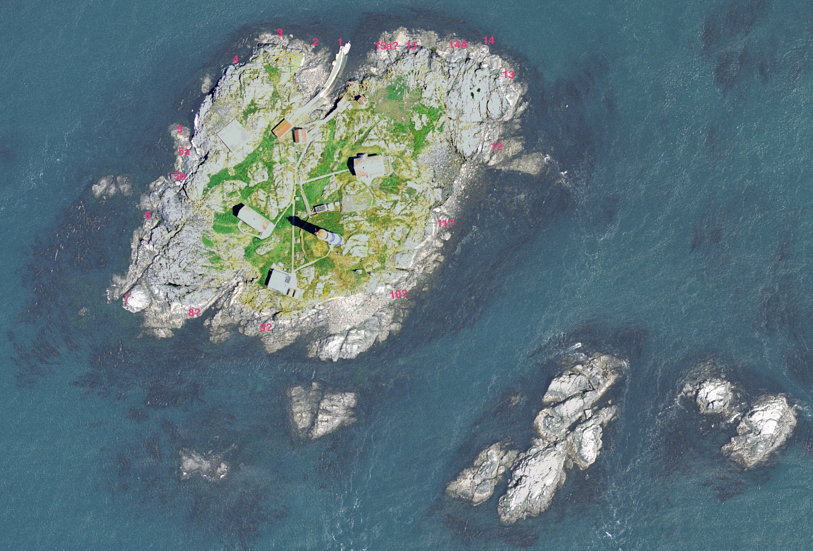
Peg 1: off west side of jetty end- subtidal
Peg 2: off point of bay west of jetty–subtidal
peg 3: further along north side– subtidal
peg 4: off base of cliff– subtidal (proved impractical because of high current)
peg 5: inter and subtidal
peg 5a:later installation- inter and subtidal
peg 5b: later installation-inter and subtidal
peg 6: for tidepool locator and intertidal and subtidal
peg 7: for subtidal minimal use
peg 8: for subtidal not used
peg 9: for subtidal not used
peg 9 : for subtidal not used
peg 10: for subtidal not used
peg 11: subtidal not used as too close to old outfall.
peg 12 inter and subtidal
peg 13: used for annual intertidal algae stratification lab exercise.
peg 14: subtidal- outer extreme North East corner.
peg 14b: inter and subtidal concrete mound with stainless steel hole for peg – inter and subtidal
peg 15: large boat mooring post — used for intertidal lab exercises
peg 15a: inter and subtidal concrete mound with stainless steel hole for peg – inter and subtidal
From peg 5 and 5a:
See Transect A0050101
See Transect A0050102
See Transect A0050103
___________________________________________________________
![]()
Return to the Contents page for Environmental modelling with Transects..