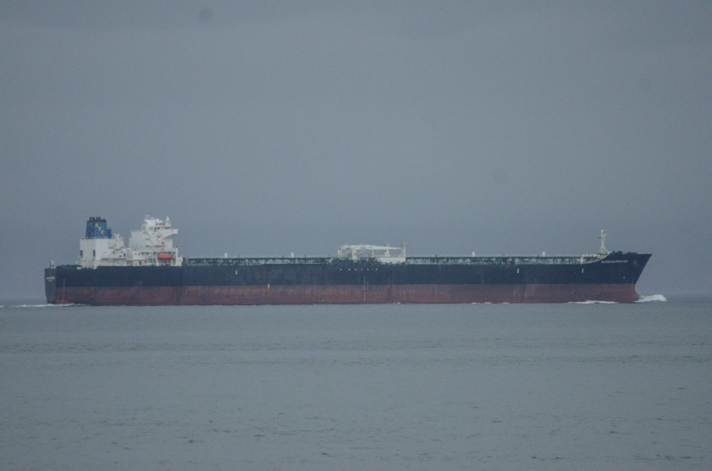
There is a constant flow of shipping traffic passing by Race Rocks to and from Seattle and Vancouver each day. Once in a while there are ships that are very loud with a low, rumbling sound that I can hear and feel in the house as they pass by. This oil tanker, the Alaskan Frontier, on its way West towards the infamous Port of Valdez, Alaska, was one of the loud ones. The information below was obtained from http://ais3.siitech.com/VTSLite/AView.aspx which tracks all major marine traffic in the area.
This ship may have been louder than others because as is shown in the photo it is sitting quite high out of the water, likely empty on its way to fill up on crude in Alaska. Which means that when carrying a load it would be projecting this sound underwater, maybe louder, where sound travels further. Which begs the question: how much noise pollution are we subjecting marine mammals to in this area? What impact does it have on their ability to communicate, hunt, and navigate? It would be great to be able to listen to the sound underwater and measure these sound levels at Race Rocks.
As well as the sound, there is the unregulated emissions from these ships. On a clear busy day there is a haze that hangs over the ocean to the East. Sometimes I can smell and taste diesel fumes out here when ships are miles away. On top of this of course is the constant risk of an accident; it doesn’t have to be a tanker to spill fuel.
With the potential of an increase in tanker traffic and tanker size in this area, to handle increased production from the Tar Sands, the focus of environmental groups seems to be on the risk of increasing traffic. I think the question we should be asking is what is the impact and risk of the existing traffic? Are there any impact studies being done? More broadly: Do we value the ocean more as an access route for cheap goods or as a habitat for marine life? What is the true cost of cheap shipping? What is acceptable risk?
On a related note, I have not seen many whales this winter.
|