How We Got Blasted: Record-ripping winds took rare path:
Judith Lavoie, Times Colonist Published: Saturday, December 16, 2006
Wind gusts at Race Rocks, off the Island’s southwest tip, reached a record 158 kilometres an hour as the third intense wind storm in a week plowed a trail of destruction through southern Vancouver Island and the Lower Mainland. Yesterday morning’s storm knocked out power to thousands of residents, toppled trees, and damaged buildings and cars. More residents were forced from their homes because they didn’t have power, and ended up moving into hotels or into the homes of friends and relatives. Around the capital region, areas that suffered the most damage had winds that gusted to between 70 and 90 km/h . In the last three storms, including yesterday’s, the wind has gathered over the North Pacific, whooshed across the ocean, gathered speed in the funnel of Juan de Fuca Strait and then whacked Vancouver Island with its full force, said Chris Emond, Environment Canada meteorologist. “There are tremendous wind speeds and three in one week is unusual.” The wind is coming straight across the cold North Pacific and hitting land, rather than taking the more common route of dipping south and picking up tropical moisture, Emond said.
Anne McCarthy, weather services specialist with Environment Canada, said the storms are cutting a swath straight across Vancouver Island instead of the more usual pattern of tracking to the north coast around Prince Rupert and the Queen Charlottes (Haida Gwaii.) Although we have only recorded extreme values since earlier this year, It is interesting to note the Maximum wind and the Minimum Pressure records for the 14th and 15th of December 2006.
You can read the complete story in the Times Colonist , Dec 16, 2006 The right conditions for a hurricane: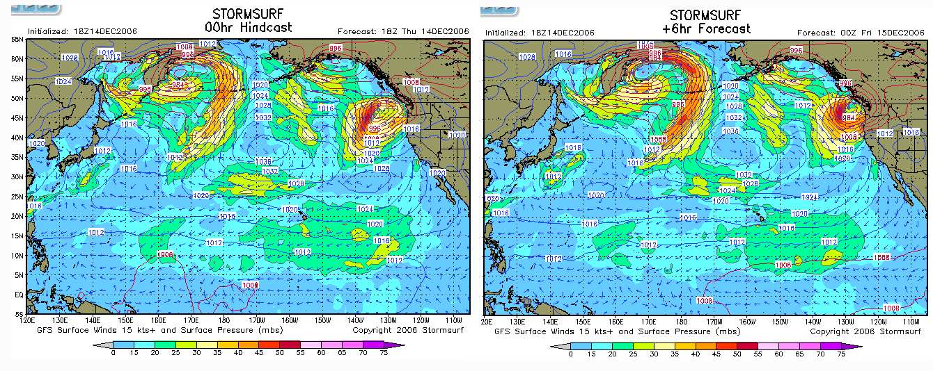
Storm surf conditions which correspond to the low pressure systems. These images were captured from the Stormsurf site at 2300 hrs. Pacific Time , just a few hours before the maximum impact.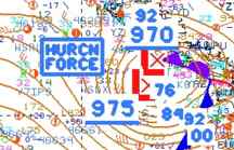
This image was taken from the US National Weather Service Images of the evening of December 14. Note the “HURRICN FORCE” location right beside Vancouver Island. Also the atmospheric pressure is as low as 970.
Current Satellite imagery is shown on this page
-
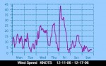
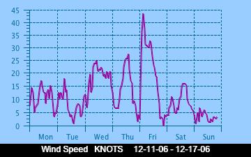
- Maximum wind speed, averaged every 10 minutes..
-
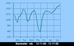
- The barometer plunged to an extreme low of 960 Millibars

-
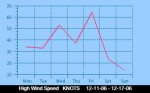
- High wind speeds are recorded here.. this is at ground level.. At the top of the tower it peaked at 158km/hr.

-
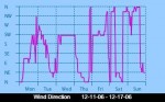
- The wind direction changed abruptly near midnight of the 14th as the advancing low pressure centre hurled toward Race Rocks from the West.

-
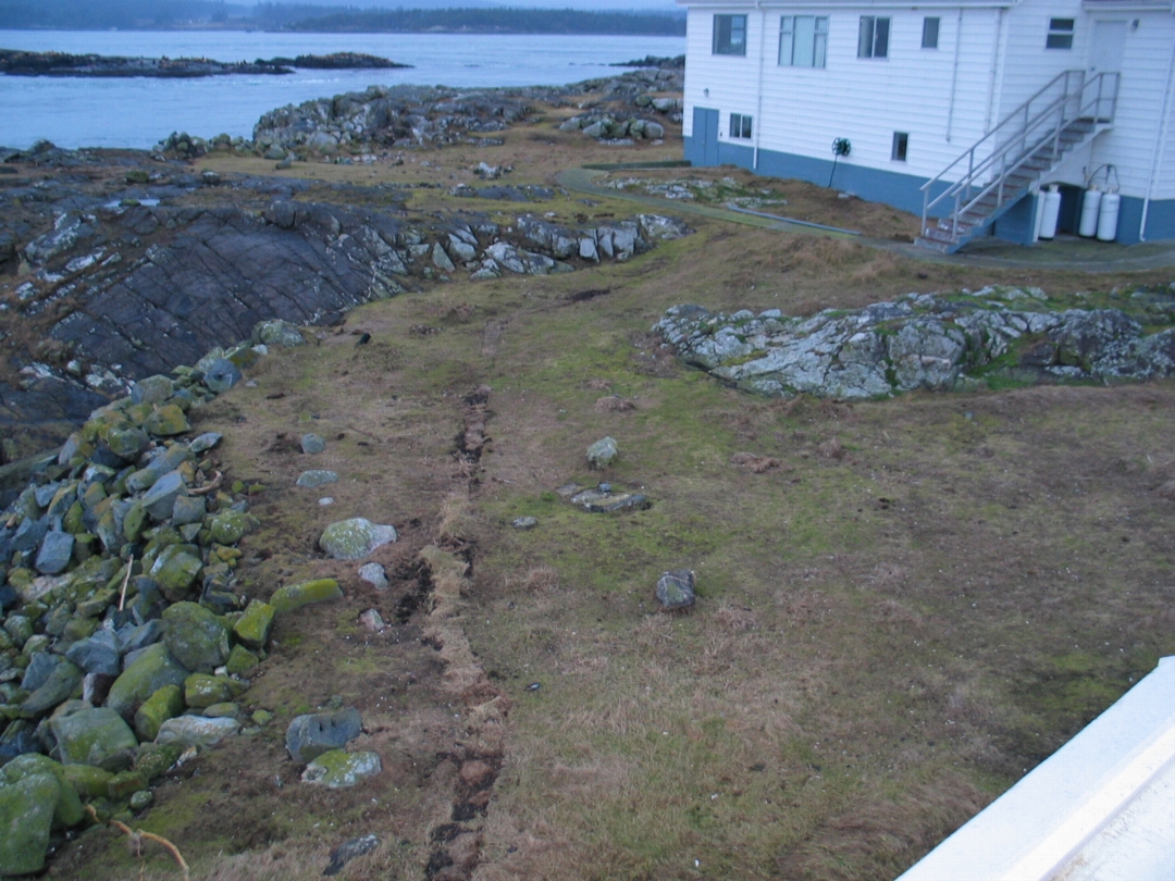
- The evidence was left on the lawn, well back from the waters edge.

-

- A newly placed water linehad the sod torn off, here it was replaced following the storm
-
- This area had boulders the size of buckets hurled up from the intertidal by the surging waves

-

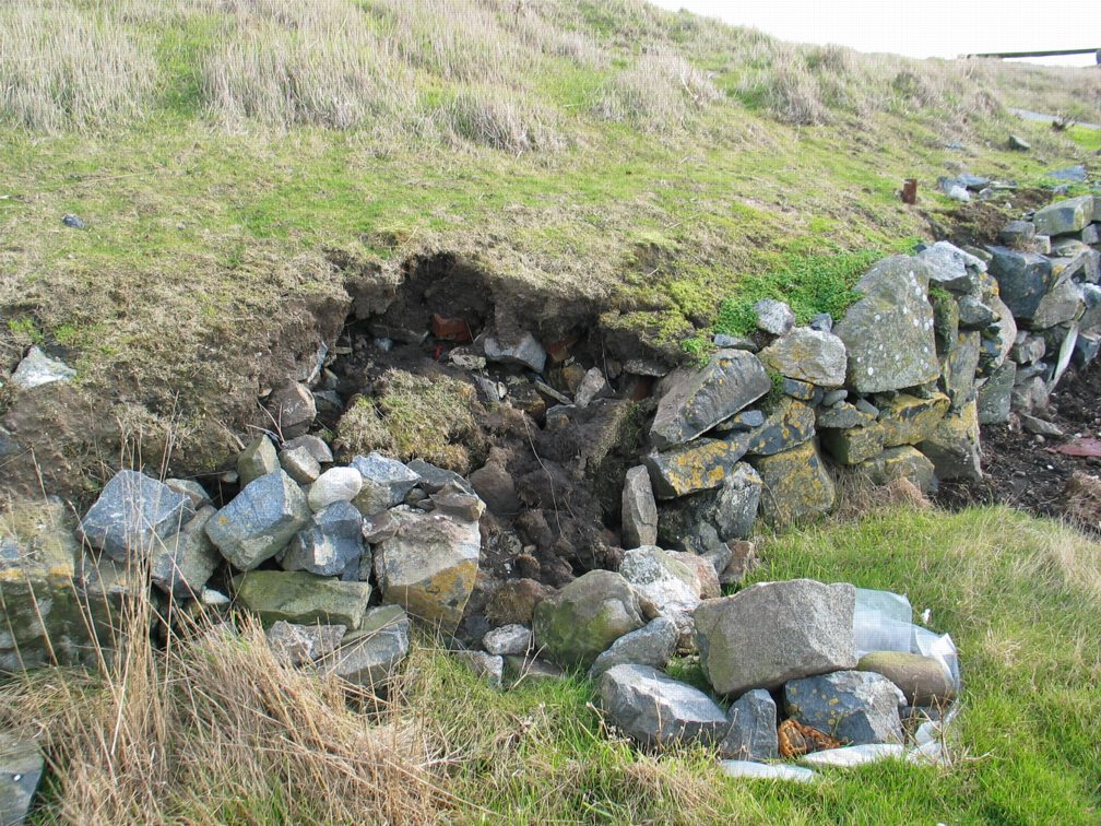
- In the centre of the island, lashing water erroded a rock wall built many years ago
-

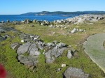
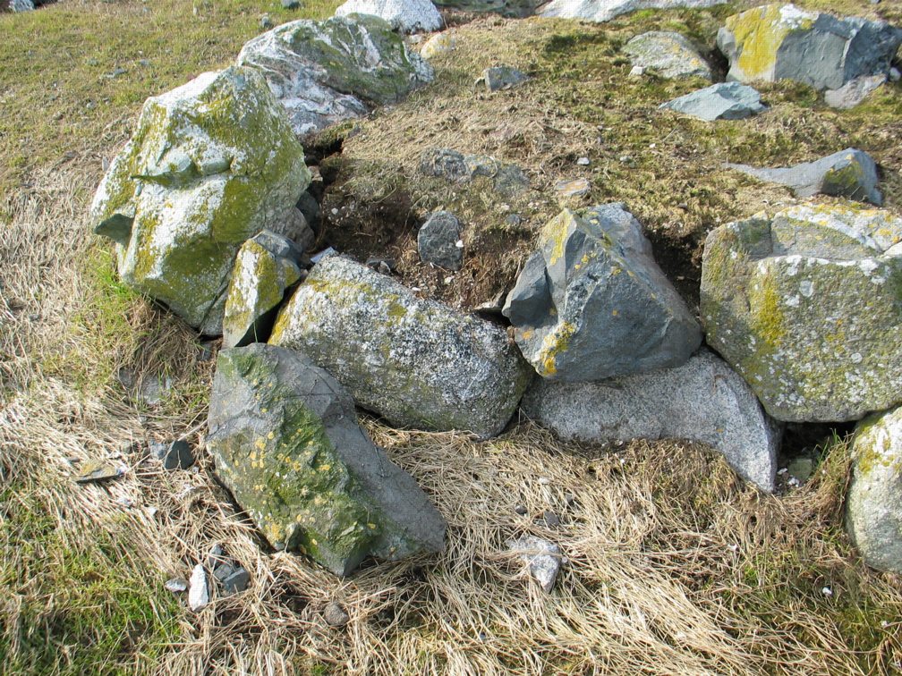
- First Nations burial cairns had rocks tumbled from their edges, and erosion of the soil from the centre of the cairn
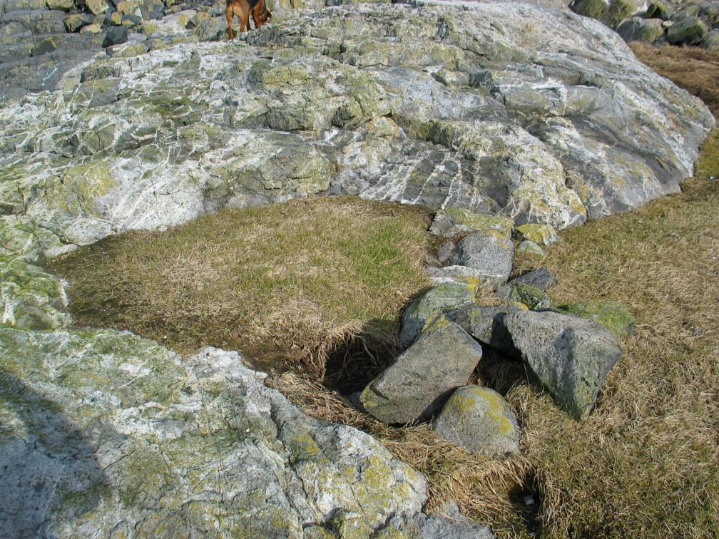
-

- These cairns were built over a 1000 years ago, and have withstood many storms during that time. Here is a page documenting the Cairns.
-
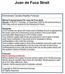
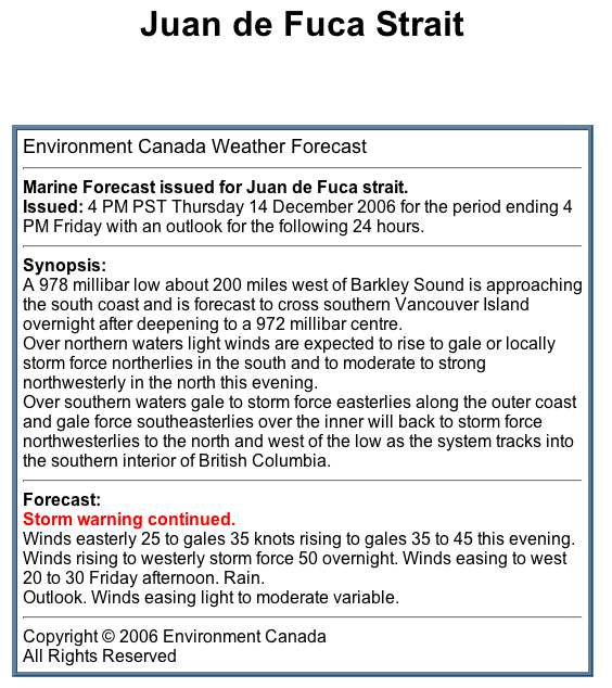
- The forecast from Env.Canada at 4:00PM Thursday did not mention hurricane force winds
-
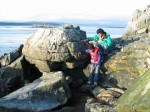
- This boulder was moved several metres. See file for the changes to the artificial tidepool from the hurricane of 2006
