2009-2014 Whale Observations from Race Rocks

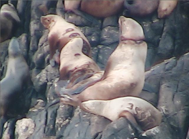
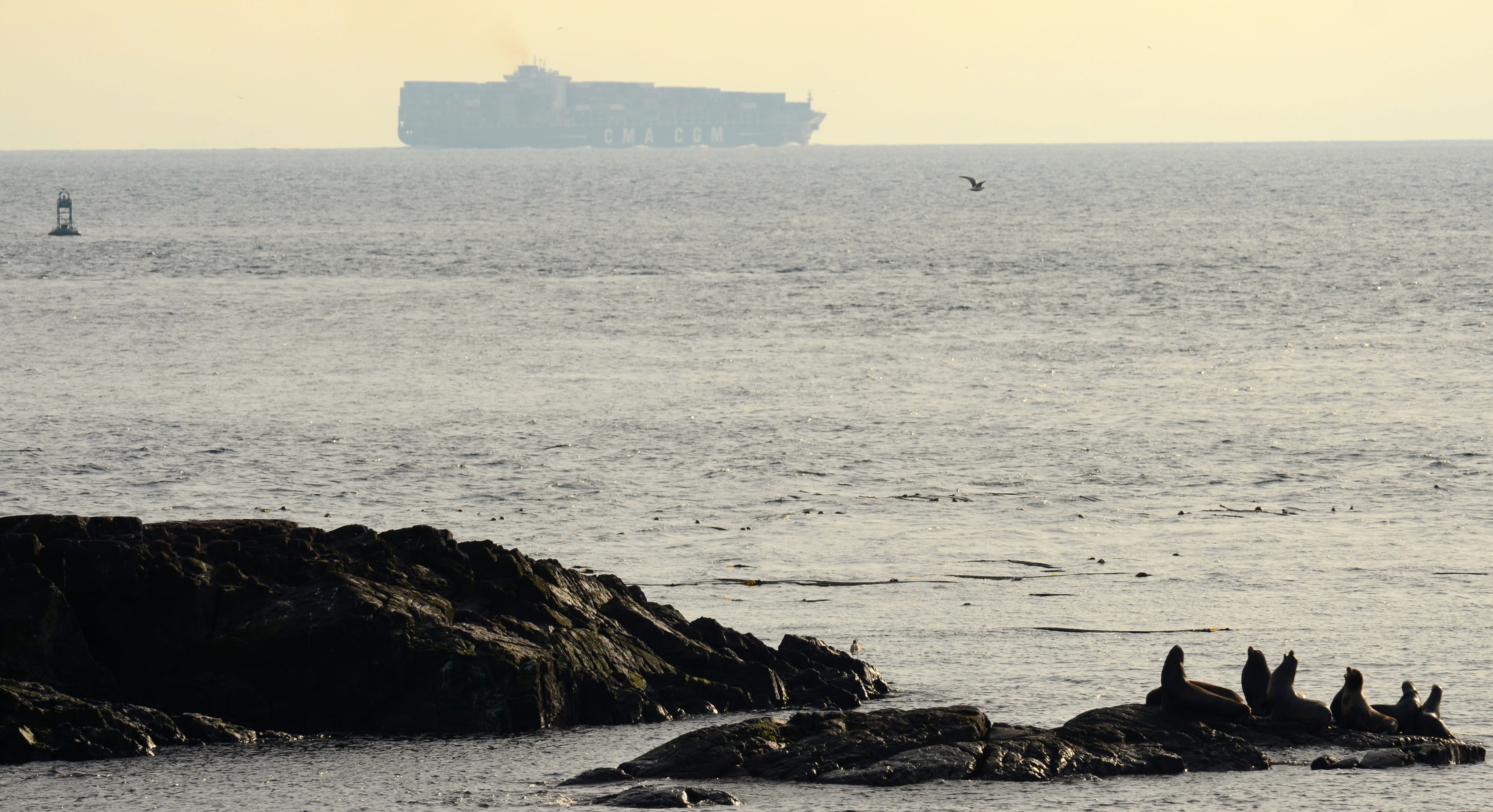
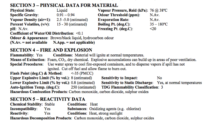
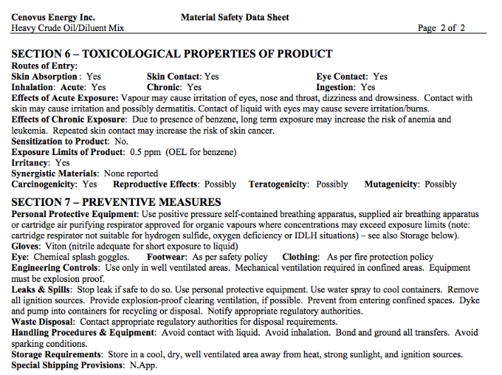
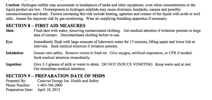
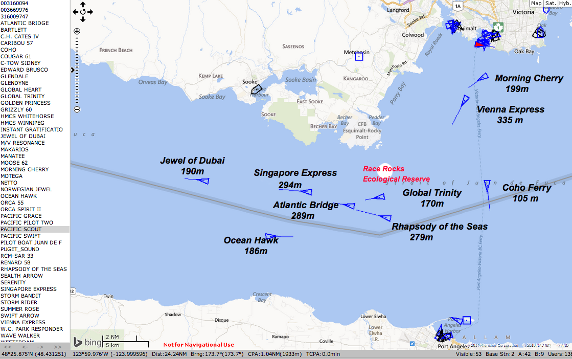
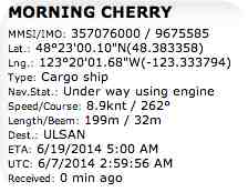
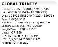
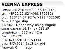
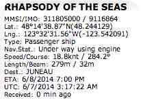
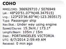
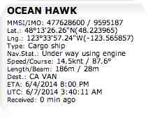
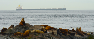
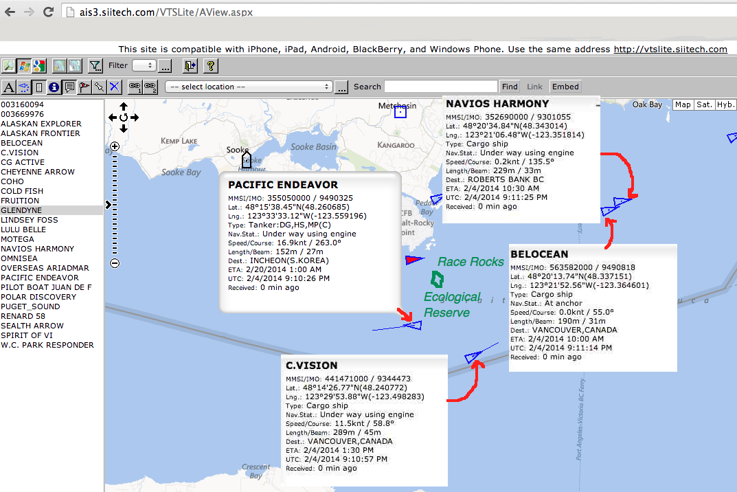
Lester Pearson College has employed the Ecoguardians at Race Rocks Ecological Reserve since 1997. One of the benefits of this is in having observers on site 24 hours on this archipelago in the Strait of Juan de Fuca. A great amount of citizen science is achieved as they record in their logs the events such as whale sightings of the area.

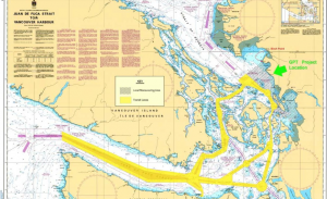
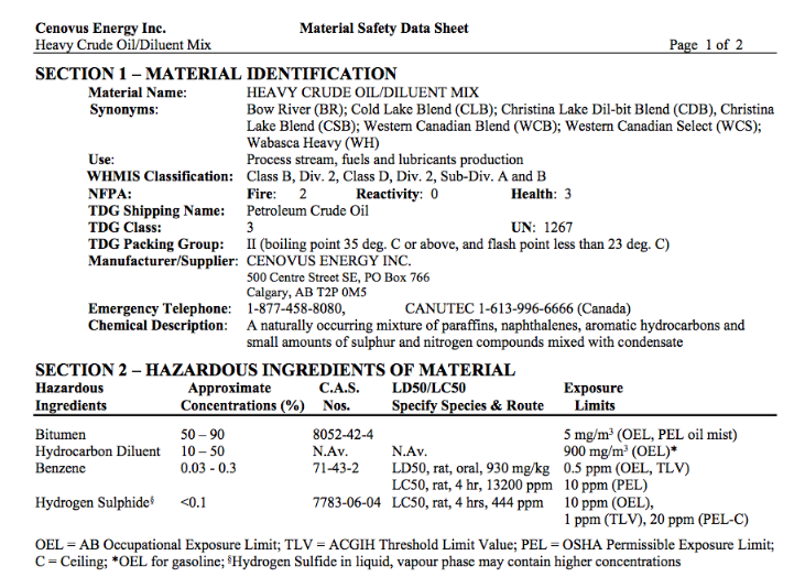
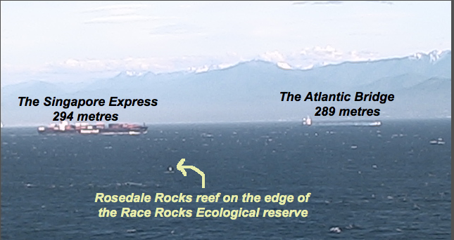
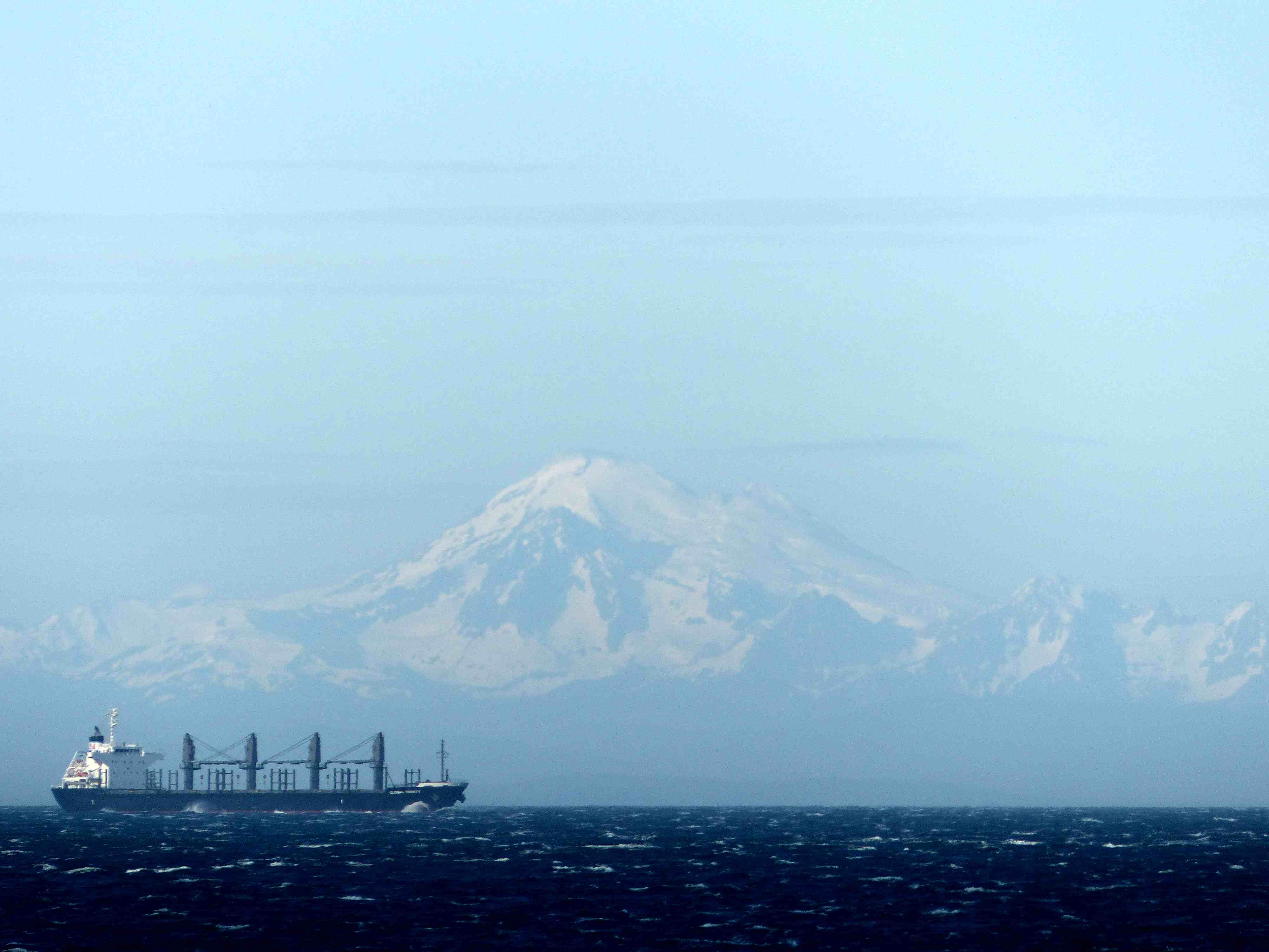
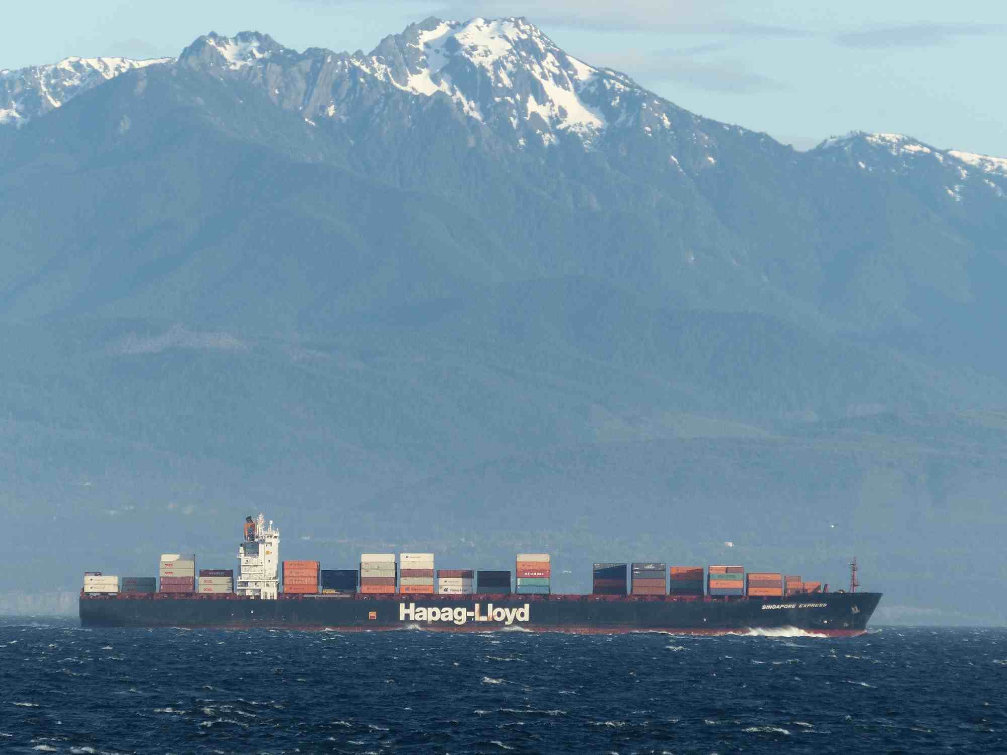
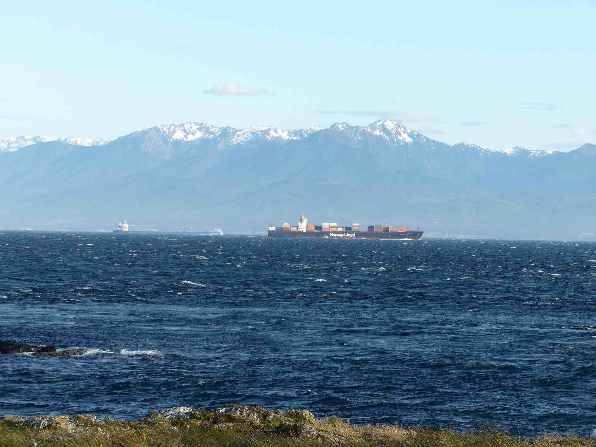
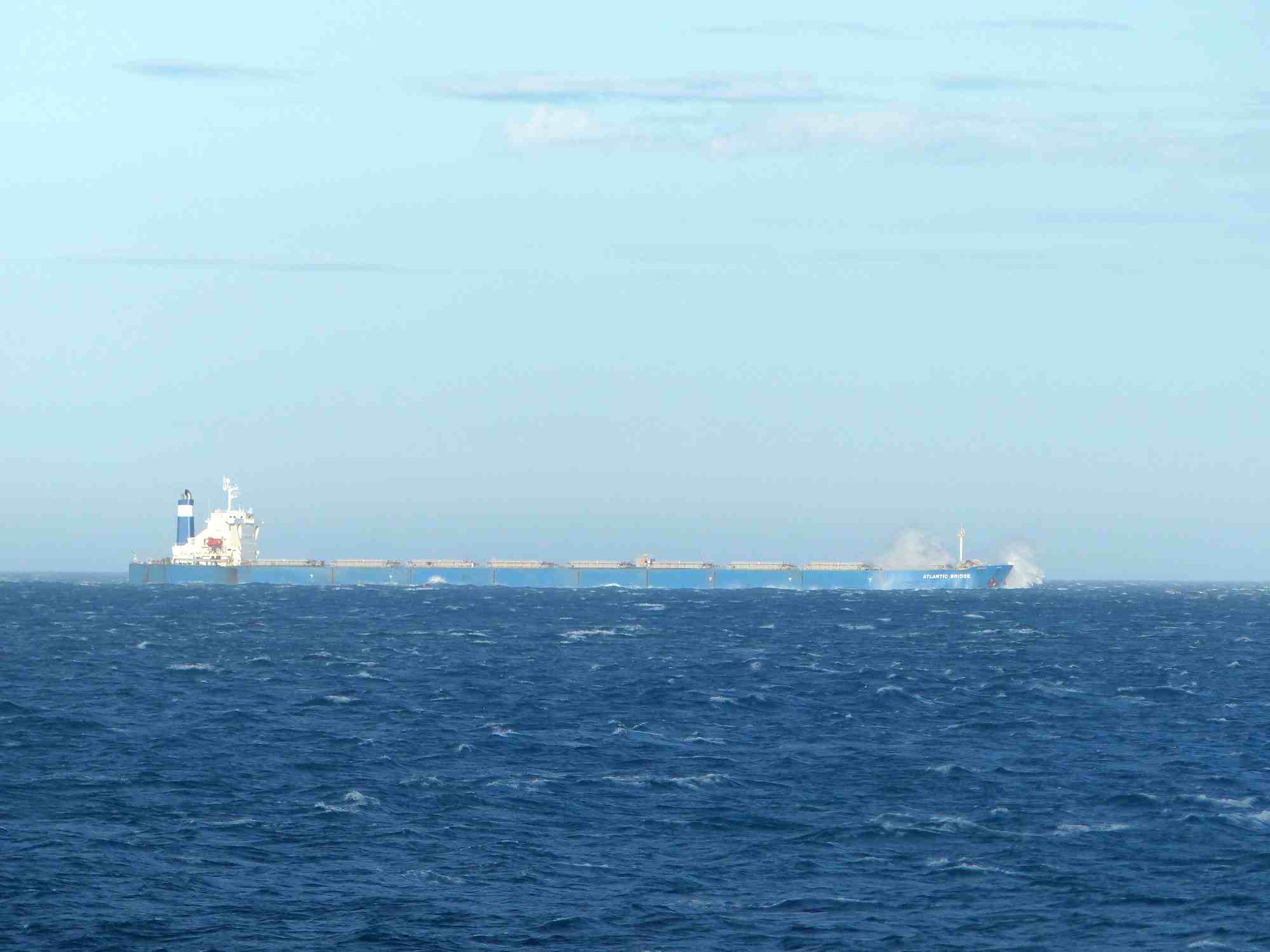
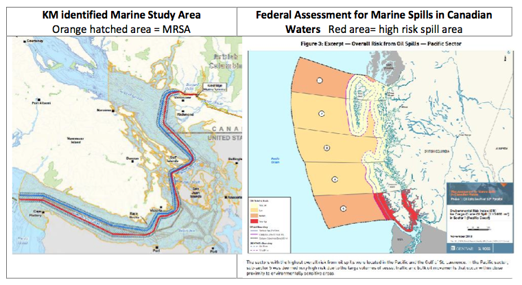
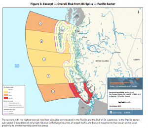
In the past year I have been working as an intervenor for the Board of Friends of Ecological Reserves to try to question and advise  the National Energy Board and the Kinder Morgan Corporation on the problems of increasing the traffic of oil tankers from the Westridge terminal through the Strait of Juan de Fuca. The area of potential impact from chronic and catastrophic oil spills puts at risk the ecological integrity of  up to 17 of our Marine Ecological Reserves around southern Vancouver Island. In our submission I was able to draw upon the records from the Race Rocks Ecoguardian’s logs to demonstrate the increase in the incidence of whales in this area. A recent report of the Department of Fisheries (Sufficiency Review of the Information on Effects  of Underwater Noise and  the Potential for Ship Strikes from Marine Shipping on Marine Mammals  in the Facilities Application for the Trans Mountain Expansion Project )has criticized the Environmental assessment done by Trans Mountain as being ineffective to take account of the increasing potential of Impact on the large whales such as humpbacks and the underwater noise which will masking of the ability of whales to communicate and get food.

I put together the following graphs to show the increase in the number of days per month that whales were observed from Race Rocks:

orcasighting
humpbacksighting

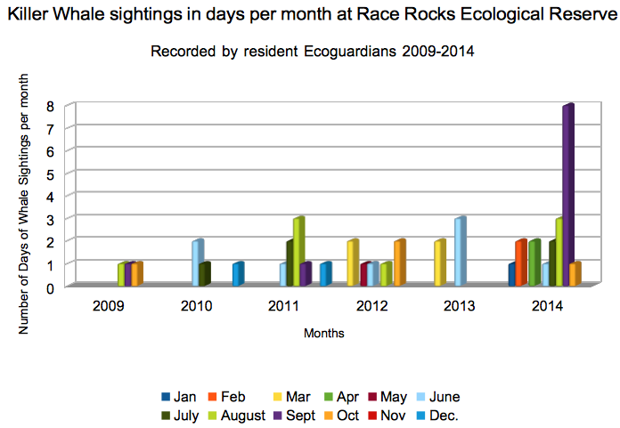
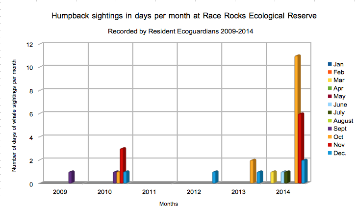
Thanks to Ryan, Raisa, Adam, Alex, Virginie, Julie, Courtney, Nick, and Anne for contributing to this database.

Addendum :  see the April 27 post on the report issued today ” Quantitative Assessment of Increased Potential for Marine Mammal-Vessel Interactions from the Trans Mountain Expansion Project TRANS MOUNTAIN PIPELINE ULC TRANS MOUNTAIN EXPANSION PROJECT –Prepared by: Stantec Consulting Ltd. 500 – 4730 Kingsway Burnaby, BC, V5H 0C6 Ph.: (604) 436-3014,

Garry Fletcher, Race Rocks Ecological Reserve Warden.


New DFO Report highly critical of Kinder Morgan /TMX environmental assessment on Whales

The recentlly released DFO report:
(See Full PDF) SUFFICIENCY REVIEW OF THE INFORMATION ON EFFECTS OF UNDERWATER NOISE AND THE POTENTIAL FOR SHIP STRIKES FROM MARINE SHIPPING ON MARINE MAMMALS IN THE FACILITIES APPLICATION FOR THE TRANS MOUNTAIN EXPANSION PROJECT was very critical of the Trans Mountain Expansion Project Application documents. The Conclusion of the report is concerned with Vessel strikes on Whales and the overall impact of noise from increased Project-related traffic.  Included below are the conclusions of the report.

Conclusions

There are deficiencies in both the assessment of potential effects resulting from ships strikes and exposure to underwater noise in the Trans Mountain Expansion Project Application documents.

There is insufficient information and analysis provided with which to assess ship strike risk in the Marine RSA from either existing or Project-related traffic. Ship strike is a threat of conservation concern, particularly for baleen whales such as Fin Whales, Humpback Whales and other baleen whales (Gregr et al. 2006). If shipping intensity increases as projected in Section 4.4 in the Marine RSA and the Strait of Georgia and Juan de Fuca Strait as a whole, the significance of this threat to cetacean populations that occupy the region will increase.

Incidence of recovered whale carcasses is not considered to be an adequate measure of the frequency of ship strikes. No information is provided about the speed and maneuverability of Project-related ships or the distribution of whales in relation to the shipping lanes. Analyses that consider the statistical probability of ship-whale encounters and the risk of collisions are considered appropriate methodologies to assess this potential effect.

The JASCO MONM model, as it has been applied by the Proponent, is not adequate to assess the overall impact of noise from increased Project-related traffic. Although state-of-the-art acoustic modelling has been used to model the noise propagation associated with a single Project-related tanker in the Marine RSA, only four locations were chosen to represent the Marine RSA; therefore, the assessment does not adequately represent the noise exposure for the entire time a marine mammal would be in the RSA. The assessment represents only Project-related tanker traffic and not the current noise environment or the potential increase due to Project-related traffic. Finally, the method used to assess the significance of impacts from the modelled noise level contours resulting from a single Project-related tanker and tug on indicator cetacean and pinniped species is qualitative and the lack of an appropriate assessment framework reduces DFO’s ability to evaluate the assessment.

(See Full PDF) SUFFICIENCY REVIEW OF THE INFORMATION ON EFFECTS OF UNDERWATER NOISE AND THE POTENTIAL FOR SHIP STRIKES FROM MARINE SHIPPING ON MARINE MAMMALS IN THE FACILITIES APPLICATION FOR THE TRANS MOUNTAIN EXPANSION PROJECT

See other posts on Oil Spill Risk for the Race Rocks Ecological Reserve

Overcast with Calm Seas

The barometer continued to drop slowly from 1023 to 1018 hPa.  The wind continued to blow between 8 and 18 knots from the northeast.  There was a difference in the weather today, compared to the clear sunny skies that have been the usual for the past week.  Low clouds hung over the Juan de Fuca Strait for most of the day.  There were occasional breaks of sun in the late morning and early afternoon.  The whitecaps this morning calmed right down in the afternoon, making the sea the calmest it’s been for the past few weeks.

There was one recreational boat seen this morning in the southern part of the reserve.

Pam Birley, from the UK, sent two photos of sea lions that she captured on Camera 1, located at the top of the lighthouse.  Pam’s photos show two branded sea lions that have never been spotted at Race Rocks, as far as I can tell.  See the photos below.  Thanks Pam!

The desalinator was run today to top up the fresh water cistern.  The solar panels aren’t soaking up as much energy, due to the clouds.  The generator was run longer today to help out the energy intensive desalinator.

Material Safety Data Sheet for Dilbit or Diluted Bitumin

If you click on the category “Oil Spill Risk” you may  have some appreciation for the potential hazards we face at Race Rocks in the event of a Oil Spill involving Dilbit which is already being shipped in some tankers through the Strait of Juan de Fuca within 4 miles of the Race Rocks Ecological Reserve, but if the Kinder Morgan Pipeline Expansion project is approved by the Canadian Government will be the contents of up to 35 tankers per month.

From the National Energy Board we can find out what is in Dilbit and what precautions we need when it lands on the shores of Race Rocks.
You can see the original here: or as copied in the images below:

https://docs.neb-one.gc.ca/ll-eng/llisapi.dll/fetch/2000/90464/90552/548311/956726/2392873/2450810/2478758/2522888/Material_Safety_Data_Sheet_-_Diluted_Bitumen_-_A4A9D1.pdf?nodeid=2508614&vernum=-2

ALSO: The following link gives the Occupational and Health Guidelines for Benzene, a Potential Human Carcinogen

https://docs.neb-one.gc.ca/ll-eng/llisapi.dll/fetch/2000/90464/90552/548311/956726/2392873/2450810/2478758/2522888/Occupational_Safety_and_Health_Guideline_for_Benzene_-_A4A9D2.pdf?nodeid=2504533&vernum=-2

dilbit1 dilbit2 dilbit3 dilbit4

Esquimalt First Nation Traditional land (and water) use areas.

In August, 2014, the Trans Mountain Pipeline consultant Tera submitted a “Supplemental Traditional Marine Resource Transportation Technical Report. 

In it, a chart is presented with areas of traditional use by the Esquimalt First Nations is presented. This is the first time this kind of map has appeared, and it is rather interesting since the Esquimalt FN remained uninvolved throughout the Race Rocks MPA Advisory Board meetings .


“EXECUTIVE SUMMARY An Environmental and Socio-Economic Assessment was completed by TERA, a CH2M HILL Company,and was submitted as part of the Application to the National Energy Board (NEB) in December 2013 for the proposed Trans Mountain Expansion Project (referred to as TMEP or the Project). The NEB will conduct a detailed review and hold a Public Hearing to determine if it is in the public interest to recommend a Certificate of Public Convenience and Necessity for construction and operation of the Project. Pending regulatory approval, Trans Mountain Pipeline ULC (Trans Mountain) plans to begin construction in 2016 and go into service in 2017.Trans Mountain will continue to engage Aboriginal communities through all phases of the Project. Traditional Marine Resource Use (TMRU) information received from participating communities will be reviewed in order to confirm literature results and mitigation measures. Additional issues of concern, TMRU sites or features identified through ongoing engagement with Aboriginal communities will be considered for incorporation into Project planning under the guidance of existing marine transport regulations and mitigation recommendations. The results of these ongoing engagement efforts will be provided to the NEBin future supplemental filings. Further information is provided in Technical Report (TR) 8B-5 in Volume 8B,  Traditional Marine Resource Use Technical Report of the Application. ”

This report contained a map of the traditional use areas of Esquimalt First Nations which shows use of the  Race Rocks Area as well as the adjacent coastline. It is shown in this link:

esquimalttraditionallanduse area

Click for large version

Friday Night Vessel Scramble in the Strait of Juan de Fuca

This evening as  I write this, 6 cargo ships (bulk carriers and container ships), a ferry and a cruise ship are all underway around Race Rocks Ecological Reserve and out into the Strait of Juan de Fuca. (as viewed on http://ais3.siitech.com/VTSLite/AView.aspx.) The wind is from the West at 50 km/hr. The total length of these outbound vessels if they were placed end to end is 1861 metres (1.861 kilometres or 6,105 feet which is 1.156 miles. )

SHIPS-at-RR-2014-06-06 at 8.17.30 PM

Ships within 4 km of Race Rocks Ecological Reserve at 8:00 pm on June 6

ocean-hawk There is also this 186 metre inbound ship called the Ocean Hawk ,     And this is how close they get to Race Rocks: Rosedaleand ships2014-06-06 at 7.53.59 PMYou can see other posts about our concern for the oil spill threat in the Race Rocks Ecological reserve here:  https://www.racerocks.ca/category/ecology/oil-spill-risk/

frontierLeadertankerOn this page we profile Marine Vessel Traffic Images which show how close they are to the Animals of Race Rocks


Click on the photos below by Courtney Edwards-taken from Race Rocks :

Ecological Reserves participate in the NEB hearings on Kinder Morgan pipeline.

The Board of the Friends of Ecological Reserves has posted their first set of Information Requests to the National Energy Board and Kinder Morgan as Intervenors in the Trans Mountain Pipeline Expansion Project . Their concerns focus on the Ecological reserves of Southern Vancouver Island such as Race Rocks .

See this link with a further link to all intervenors Information requests.kmstudyarea


Ships Currently in the Area of Race Rocks, and the Associated Hazards

Shipping in the Strait of Juan de Fuca poses the greatest risk to the ecological integrity of the Race Rocks Ecological reserve. The risk of chronic oil spills increases directly with the Number of vessels in the waters. Chronic oil is a greater risk to marine life around the world than are the disastrous large spills, but the risk from both will increase if tanker traffic is allowed to proliferate in the Strait of Juan de Fuca:

These tagged posts detail the risk to this and other Marine Ecological reserves on southern Vancouver Island: https://www.racerocks.ca/tag/oil-spill/

frontierLeadertankerOn this page we profile Marine Vessel Traffic Images which show how close they are to the Animals of Race Rocks


The live tracking image below shows the ships, their size and other details that are in the Strait around Race Rocks right now.

Either go to this site and create a username and password to access:

or use the more restricted map below:


View Larger Map

Problems with Marine Vessels and their risk for Race Rocks:

It has always been a concern that Race Rocks is located in a very vulnerable location in the Entrance to the Strait of Juan de Fuca. There is a need for regulations preventing the dumping of bilge and sewage from ships, and an emergency plan in the event of disaster from marine shipping.Shipping  Prshipwreckoblems:
The history of shipping in the past in the area is grim evidence that accidents happen. A fuel or chemical spill in the Strait of Juan de Fuca would have an untold impact on the biodiversity of the Ecological reserve.shipwreckMajor Marine Vessel Casualty Risk and Response Preparedness in British Columbia
Prepared for Living Oceans Society
Sointula/Vancouver, BC Canada
by EnviroEmerg Consulting Services Cowichan Bay, BC Canada
Government of Canada Announces Ballast regulations, June 2006
Cruise Ship Problems:
Screen Shot 2014-04-01 at 9.35.14 PM
See the following reference link on potential problems from Cruise ships and how they can be rated for environmental safety with the Cruise Ship Environmental report card.Cruise Ship Dump Raises Alarm
Louise Dickson, Times Colonist
Thursday, May 08, 2003
The accidental dumping of raw sewage into Juan de Fuca Strait has renewed calls for stronger environmental regulations governing cruise ships.Norwegian Cruise Lines has confirmed that its ship, Norwegian Sun, dumped about 62,000 litres of raw sewage into American waters near Port Townsend, southeast of Victoria.
Victoria’s Cruise Ship Industry: Economic Benefits and their Environmental ImpactsBy: Elliot Houlston and Carly Daoust , 2005″Being that a cruise ship functions like a small city, it will pollute like a small city as well. In one week’s time a single cruise ships empties 210,000 gallons of sewage (human waste), 1,000,000 gallons of grey water (water from sinks, bathing and washing), 8 tons of solid waste (paper, plastic, cardboard, food waste) and 25,000 gallons of oily bilge water8. Some hazardous wastes such as photo chemicals and used paint are produced also. These are only the water pollutants created by cruise ships. There are many air pollutants as well.”Dirty Waters: Cashing in on Ocean Pollution 18 January 2010 in DC BureauBy David Rosenfeld
Return to Index of Environmental Disturbances to the ecosystem at Race Rocks

Ship Traffic in the Strait of Juan de Fuca

If you go to the website for tracking  marine vessels  (http://vtslite.siitech.com/VTSLite/AView.aspx ) you can see the vessels currently in the waters around Race Rocks. Today I checked and at one time noted the four vessels indicated on the chart below.

mapandships Today the wind is blowing from the north-east  at 5o Km ph.
I took a picture from Camera1 of the tanker Pacific Endeavor just south of Race Rocks :

figure-3-overall-risks-oil- spills

With the projected increase in traffic of tankers in the Strait of Juan de Fuca, the risk of an oil spill doubles.See this recent government report on Risk Analysis.