EXISTING SHORELINE CONDITIONS STUDY EAO Condition 39

The full pdf of this report is contained in this pdf:
BC EAO Condition 39 Exisitng Shoreline Conditions Report – May 2023 – for engagement

The purpose of this posting is to reference the part of the report referring to Metchosin’s coastline including Race Rocks and to provide comment on it.

===========================================================

From page 4 of the REPORT:
1 Introduction
As defined by the amendment to Trans Mountain’s BC Environmental Assessment Certificate (EAC) issued by the Province of British Columbia (the Province) on February 24, 2022, Trans Mountain must prepare an Existing Shorelines Condition Report and submit to the Province within 18 months (August 2023) as Condition No. 39.

Polaris Applied Sciences was retained to prepare a report containing shoreline baseline data for shoreline areas closest to spill scenario locations modeled along the marine shipping route and submitted in the Project application. The Province listed the specific scenario locations for the purpose of this study (Figure 1) as:

  • English Bay (Location B)
  • Roberts Bank (Location C)
  • Strait of Georgia (Location D)
  • Arachne Reef (Location E)
  • Strait of Juan de Fuca (south of Race Rocks) (Location G); and
  • Buoy J (Location H)


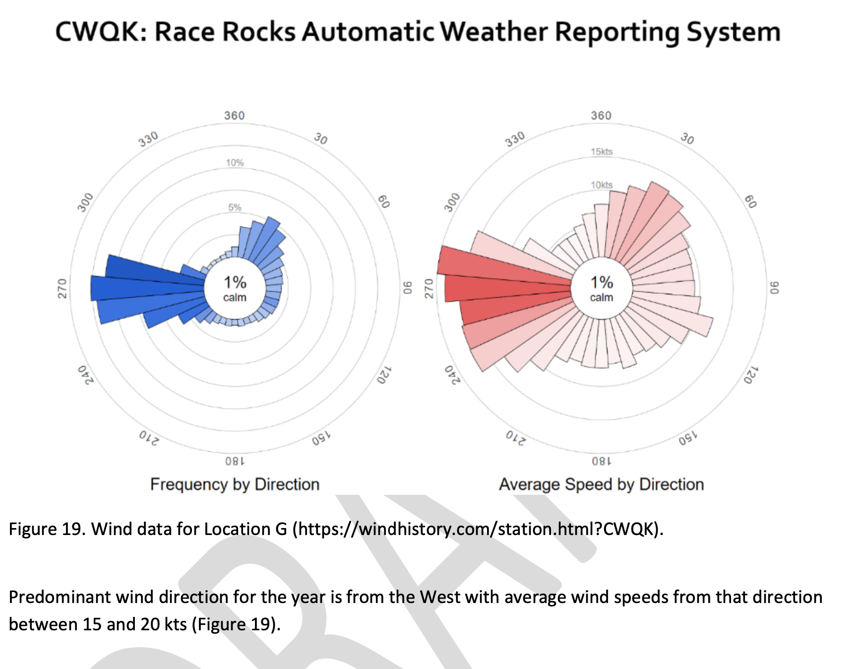
Page 25
Strait of Juan de Fuca (south of Race Rocks) (Location G);
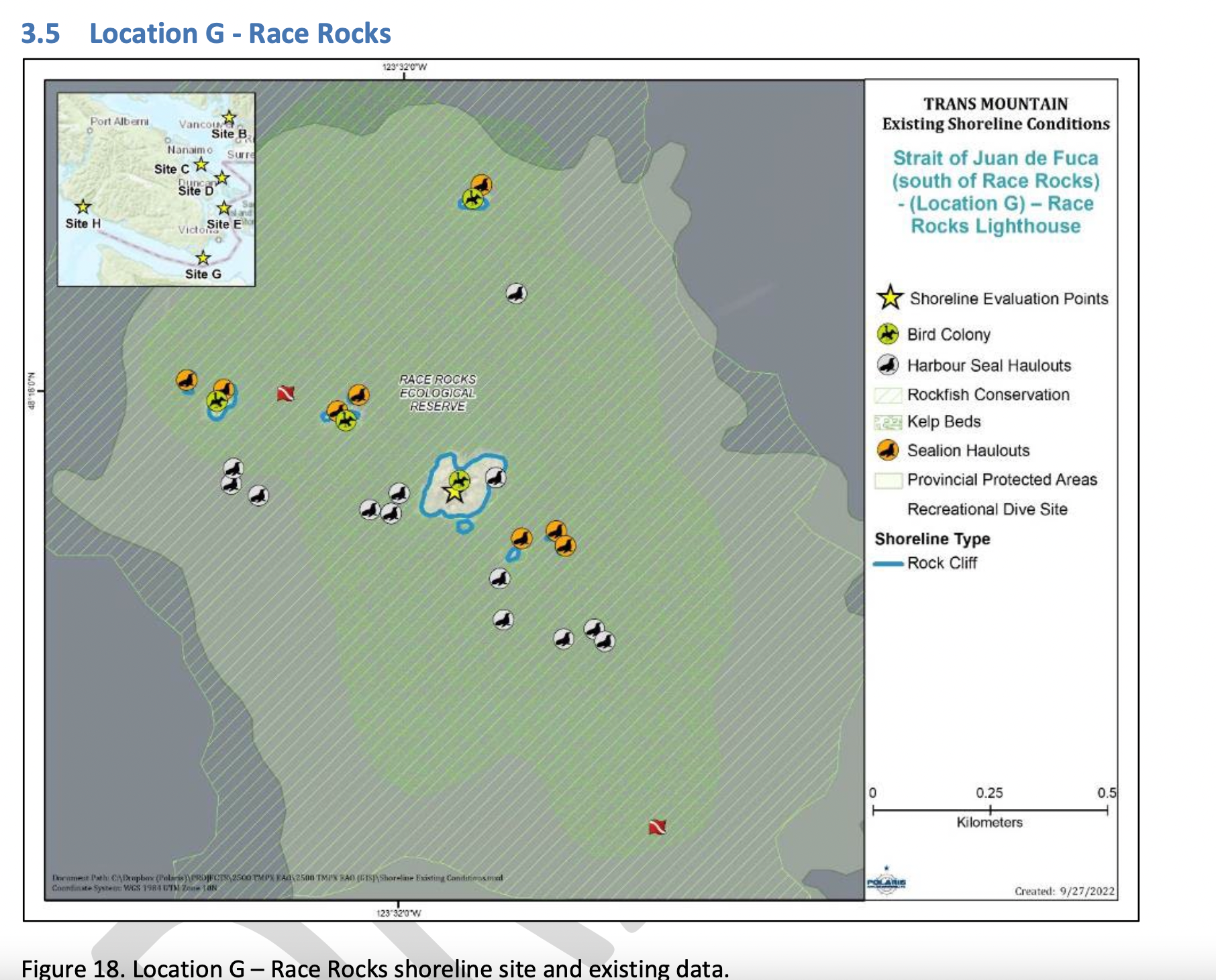
Figure 18 shows the Location G – Race Rocks site with the available existing spatial data. Shoreline data are from the Shorezone mapping effort available from the BC Data Catalogue, which show the shore type consisting of rock cliff. Shore-zone Bioband data indicate the presence of barnacles, dark brown kelps, fucus, bull kelp, red algae, surf grass, and Verrucaria. Other data sources indicate offshore kelp beds and multiple seal and sealion haulouts. The Race Rocks Ecological Reserve (RRER) website (https://racerocks.ca/home/) provides more details on ecological resources documented and studied at the site, but not in a spatial format for mapping.

COMMENTS :  The exceptionally high Biodiversity of the area and high level of protection since 1980 as a Provincial Ecological Reserve  are not reflected at all in the map presented. If one were to look at the Race Rocks Taxonomy presented at https://racerocks.ca/race-rocks-animals-plants/taxonomy-image-gallery/ there may be a better appreciation of the natural capital of this area

  1. Rock Cliff  Beach designation is inaccurate.. there is a pebble beach and Intertidal areas with tidepools on much of the shorelines of the 9 islandfsd in the Archipelago.  Also several surge channels are located around the main island. 
  2. Bird Colonies :
    –no mentions is made of four species of nesting seabirds.
    –no mention is made of the fact this is a winter roosting area for thousands of seabirds.
    — no mention of the fact that the archipelago of islands are an important migratory stopover for marine and terrestrial migratory birds.
  3. Marine Mammals:
    –no mention is made of the fact this is the most northerly haul-out and pupping colony  for Elephant seals — no mention of the fact that California and Northern sealions haul  out in numbers over 1000 in the fall of the year. 
    —no mention  that the haul-out locations for harbour seals are also pupping colonies. 
    — no mention of the ocurrence of river otters and sea otters on and within the islands.
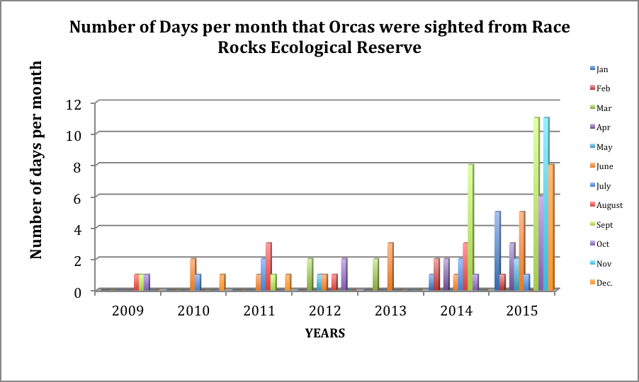
    – no mention of the fact that it is an important feeding area for Biggs killer whales. https://racerocks.ca/humpback-and-orca-sightings-race-rocks/
    –no mention of the fact that the surrounding waters have had a rapid increase in the past few years of Humpback whales 
  4. Invertebrates: 
    –The extremely high biodiversity of invertebrate species both inter-tidally and sub-tidally is not mentioned. 
    –Several rare species of invertebrates are found here and are not acknowledged
  5. Fish :
    –This is a rockfish protection area and all species of BC Rockfish are represented.– a high diversity of other fish are also represented here,  with even sitings of Sturgeon occurring.
  6. Marine Algae :
    –There is a much higher  species diversity of Marine Algae found in the ecological reserve than is n surrounding areas. 
    — the indication of kelp beds on the map presented here is totally inaccurate and insufficient.  Given the decline of kelp beds in our coastal water , this is highly relevant. 
  7. Indigenous and Historical Significance: 
    — the presence of archaeological sites and the significance of the historic structures cannot be minimized . All are sprayed with seawater and therefore subject to immersion in pollutants during intense winds  which occur regularly. 

===============================================================

Page 26


Comments:
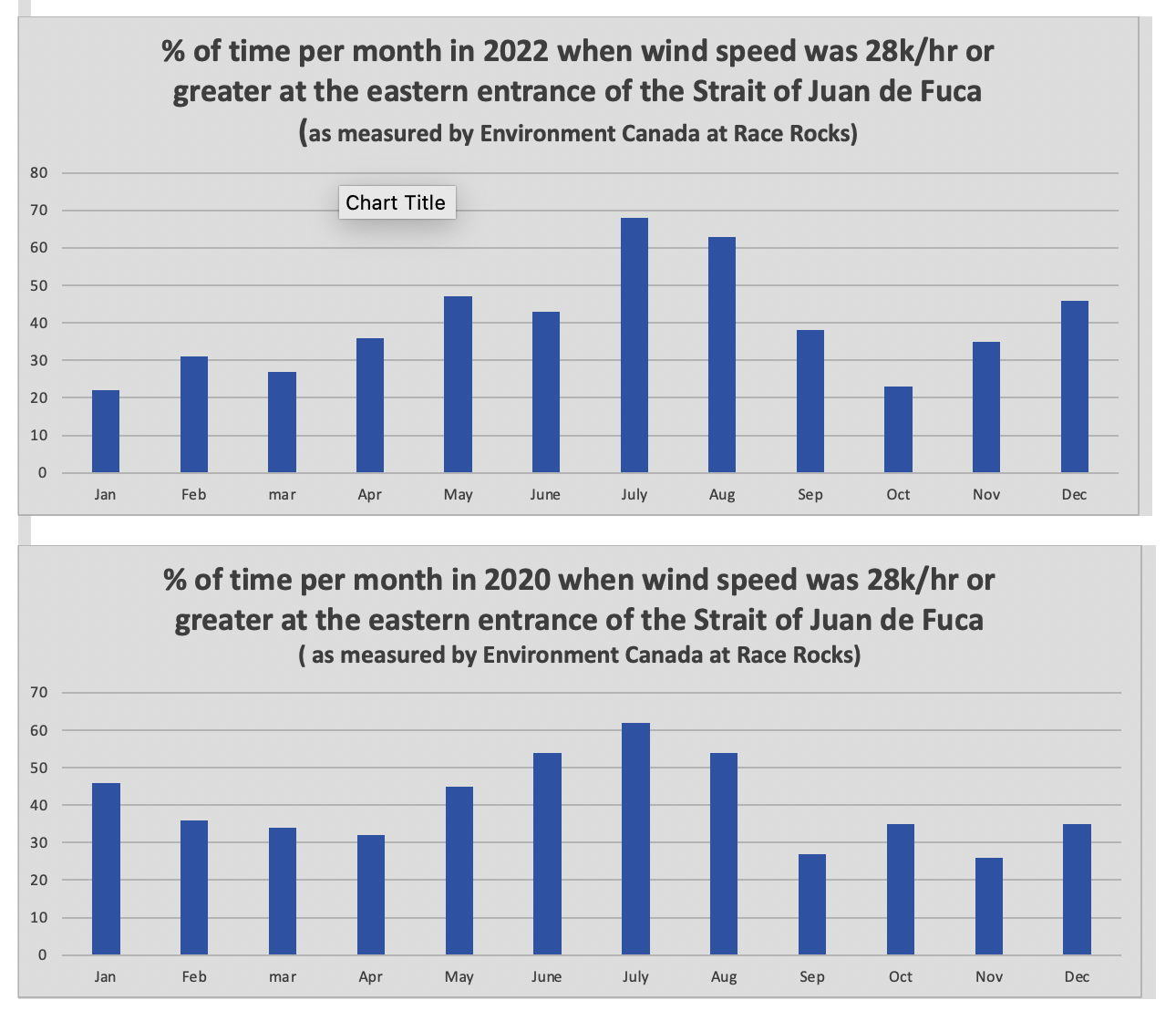
The reference at the Race Rocks website  from racerocks.ca which analyzes the Wind speed from observations of the hourly data provided by Environment Canada show a completely different picture . https://racerocks.ca/race-rocks-lightstation-weather-conditions-environment-canada-problems-for-oil-spill-cleanup/

 Some facts from the Environment Canada data:
1. In July of 2022  there were 11 days when the wind speed every hour was 28 km/hr or greater. and 69.5% of the hours in the month, clean up equipment could not be deployed due to high velocity wind conditions.
2. In March of 2023, the wind speed was 28 km/hr or greater  37% of the time.
3. In Februarry of 2023 , the wind speed was 28 km/hr or greater 43 % of the time
4. In January of 2023 , the wind speed was 28 km/hr or greater 36% of the time 

============================================================

Page 27


================================================

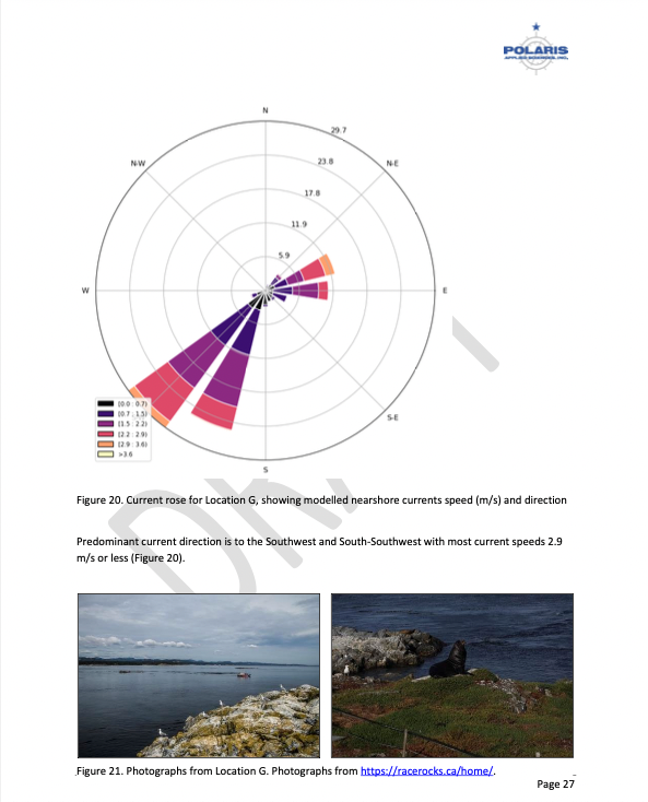
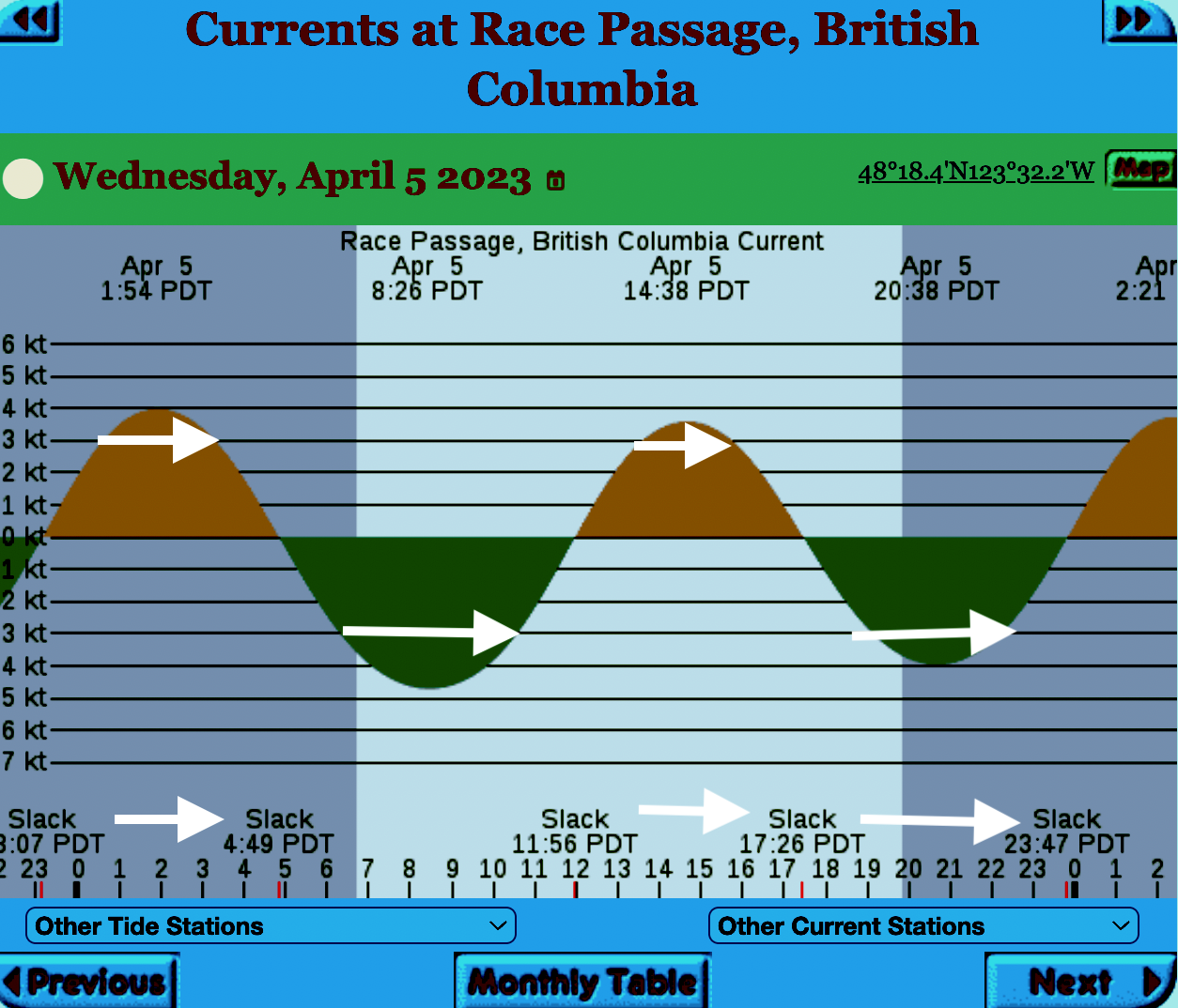
The reality of current speed  is that there is a very small window of time during the day that the waters around Race Rocks are not over three knots. In the graph below only in the few hours a day not covered by the white arrows could any boom placement be established. WHen looked at from this perspective, added onto the small windows of time when the wind speed is under 28 km per hour could spilled oil containment even be possible. 


=============================================================

From page 28 of the Polaris report

Field surveys were not conducted at Race Rocks due to the long lead time in acquiring a “research” permit from BC Parks to access the Ecological Reserve. Information detailed below comes from reviewing the existing data available, Google Earth, the RRER website, and a First Nations representative.
The shoreline at Race Rocks, specifically Great Race Rock, appears to be mostly bedrock cliff, ramp, and platform, possibly with some small pocket pebble/cobble beaches. Bedrock cliffs and ramps are observable in Figure 21 which show some example photographs from the Race Rocks Ecological Reserve website. The backshore appears to be mostly bedrock with some vegetation.
An active lighthouse along with several other buildings are present. Pearson College UWC conducts research and teaches classes at the site. Whale and sightseeing boats frequent the waters around Great Race Rock and are visible from photographs on the Race Rocks website and on Google Earth.
As mentioned before, Race Rocks is a BC Parks Ecological Reserve which are “areas selected to preserve representative and special natural ecosystems, plant and animal species, features and phenomena. Scientific research and educational purposes are the principal uses of ecological reserves”7. A wide variety of ecological resources are documented, tracked, and studied at the site. This documentation includes a weekly animal census, annual bird counts, and an entire list of species ever documented with photos/videos since 2000 (https://racerocks.ca/race-rocks-animals-plants/taxonomy-image-gallery/). Additional research conducted at the site can also be found on the RRER website. The extensive use of the site as a haulout location by pinnipeds is documented on the website and visible on Google Earth.
This area has historically been used by First Nations for harvesting food, as documented on the Race Rocks website, and a First Nations representative indicated that fishing is common in the waters around the site. Burial mounds/cairns have been researched and documented on Great Race Rock.
A helicopter pad is located near the lighthouse.
Based on the available data, and without visiting Race Rocks, the Shorezone mapping appears to be relatively accurate. The detailed observation of the flora and fauna on the Race Rocks website and other research conducted by Pearson College provides the most thorough documentation of the ecological resources present compared to any of the other sites visited.
7  https://bcparks.ca/eco_reserve/

================================================================

================================================================

So much of what we are expected to do in response to the Trans Mountain EAO requests has been done before. 
However…. 
I am pointing out some information from work that Mike Fenger and myself did on the Board of Friends of Ecological Reserves the past for the NEB hearings . 
1. In this document, although it  lists species of several of the marine ecological reserves,  Race Rocks is included with examples 
page 48 -page 54 : Marine mammals
see page 52  
page 55-page 61 Birds 
page 63-67  fish (including forage fish on our beaches
page 67- page 71 .. Invertebrates
page 72- page  74  .. macroalgae
page 75-  terrestrial plants in upper foreshore areas
From this link ….
there is a lot of information of the biological resources along the Strait of Juan De Fuca also in section
3.5 SARA-Listed Species in Two Ecological Reserves and in appendix page 139
============================================
Garry Fletcher.. Metchosin Environmental Advisory Select Committee 


Race Rocks Lightstation – Weather Conditions – Environment Canada- and Problems for Oil-spill cleanup

Environment Canada has weather sensors installed at the top of the lighthouse at Race Rocks Ecological Reserve. When windspeed was noted for every hour of the year, the reality of how ineffective Oil spill Cleanup would be becomes evident.

Hourly weather conditions summary for the past 24 hours. This includes conditions, temperature, humidity, dew point, wind speed/direction, air pressure, visibility, and wind chill/humidex (when applicable)


The archive of past data for every hour per day of each month go to this Environment Canada website link and enter the year month and date to access the data.


From this archive analysis can be made of wind speed conditions in the Eastern Entrance of the Strait of Juan de Fuca. We are concerned that although the claim is made that Canada has World Class oils spill  response capabilities , the reality is that for a large portion of time cleanup by booms and skimmers is not possible because the equipment cannot be deployed at wind speeds above 28 km/hr.

Some facts from the Environment Canada data:
1. In July of 2022  there were 11 days when the wind speed every hour was 28 km/hr or greater. and 69.5% of the hours in the month, clean up equipment could not be deployed due to high velocity wind conditions. 
2. In March of 2023, the wind speed was 28 km/hr or greater  37% of the time.
3. In Februarry of 2023 , the wind speed was 28 km/hr or greater 43 % of the time 
4. In January of 2023 , the wind speed was 28 km/hr or greater 36% of the time

5. In the first week of April 2023 the wind speed was 28km/hr or greater 51% of the time

In the graph above, the  white arrows in the current table of Race Passage in the
Eastern entrance of the Strait of Juan de Fuca represent the times of the day on on April 5 when current speed was above the speed of 3 nauts, the speed at which equipment deployed for containing oil spills on water fails. This means only
brief windows when the tide is changing would oil spill retainment be possible.

Oil cleanup near Island impossible much of the year TC May 2019

I was involved as an intervenor  in the NEB reconsideration Hearings in the fall of 2018. We presented the wind data from Race Rocks which confirms much of the information in this newspaper article. Note Race Rocks is also  mentioned below:

From The Times Colonist -Island Voices: May 26 2017 

Oil cleanup near Island impossible much of the year

If an oil spill occurred in the Juan de Fuca Strait, a cleanup would be impossible or severely limited 198 days of the year, according to Christianne Wilhelmson, executive director of the Georgia Strait Alliance

If you are wondering whether our coast is ready for an oil spill, you might like to know that responding to one at the mouth of the Juan de Fuca Strait, near Port Renfrew, would be impossible or severely limited 198 days of the year.
As part of the National Energy Board’s re-review of the Trans Mountain pipeline expansion, Georgia Strait Alliance examined the physical limits of booms, which are foundational pieces of equipment to contain and deflect spilled oil. We compared their limits to wind, wave and currents along the tanker route, and found that responding to a spill on our coast is likely to result in a significant amount of oil being left in our marine environment.

Most of the booms used to respond to spills along the tanker route are meant for protected water areas, such as harbours. They aren’t built to withstand the currents we find along the route, with 87 per cent of them failing at about 1.5 knots (2.8 km/h). Even the most effective high-current booms on our coast fail at four knots. Meanwhile, in some locations, such as Race Rocks on the southern tip of Vancouver Island, currents can exceed seven knots.
Strong wind and waves carry oil over or under booms, sometimes even breaking them. In the heaviest weather, booms can’t be deployed. Wind and waves surpass boom capabilities for days, sometimes weeks, at a time during the fall and winter at the mouth of the Juan de Fuca Strait. If an oil spill were to happen during one of these periods, our coast would likely be awash in oil.
When the tug Nathan E. Stewart sank in Heiltsuk Nation territory in the northern part of the province in 2016, weather conditions suspended spill cleanup for 11 of 40 days of recovery efforts recovered 1,400 litres of oily water and waste, leaving 110,000 litres of fuel and lubricant in the surrounding waters. The spill contaminated shellfish harvesting areas, forcing the Heiltsuk to halt food and commercial harvests, as well as cultural practices.
Unfortunately, this level of failure is common. The International Tanker Owners Pollution Federation estimates that 10 to 15 per cent of spilled oil is recovered, with the weather limits of spill equipment being a major factor. Spills are complex and difficult to manage — and their repercussions last for decades. We’re 30 years on from the Exxon Valdez disaster in Alaska, which saw the loss of thousands of local jobs and the functional extinction of a pod of orcas, and oil is still being found on beaches in Prince William Sound.
An outcome such as this isn’t one that the people who live and work in the Salish Sea area should have to navigate. The federal government can say no to the expansion of the Trans Mountain pipeline and protect our coast from the risk of a future spill.
The government’s rationale for the pipeline expansion is unravelling: The NEB acknowledges there would be devastating impacts to southern resident orcas; Alberta’s carbon tax and oil-production cap are on the chopping block with the election of Premier Jason Kenney; and oil-spill response is nowhere near being “world-class.” The NEB recommends reviewing nearly every aspect of how we respond to spills — from response resources to the methods we use for spill response to including Indigenous and municipal governments in planning.
The federal government continues to claim that this project is in the national interest, while evidence and research suggest otherwise. The economic case for fossil fuels is unravelling, as the benefits of government revenues and jobs decline, while the impacts of their production on climate change and the natural world continues to climb.
It is time for Prime Minister Justin Trudeau to acknowledge that the government’s case for Trans Mountain is crumbling and move on from this project that puts our coast at risk.

Christianne Wilhelmson is the executive director of Georgia Strait Alliance, a regional marine conservation organization and intervener in the National Energy Board process.

NEB, Trans Mountain Reconsideration Hearings

The Friends of Ecological Reserves Board Members Mike Fenger and Garry Fletcher have worked since late September in serving as Intervenors In the NEB, Trans Mountain Reconsideration Hearings. Their aim was to attempt to ensure some level of protection for the shorelines of our 19 Ecological Reserves on southern Vancouver Island including Race Rocks and other sensitive ecosystems in the event of a catastrophic spill of diluted bitumen in the Salish Sea and Juan de Fuca waterways because of the projected increase of marine transport of oil from Western Canada.

You can access our Opening Statement and Direct Evidence at this link:

https://apps.neb-one.gc.ca/REGDOCS/Item/Filing/A96487

We wish to acknowledge the work of Louise Beinhauer of L.B WordWorks in editing and assisting us to put together our Direct Evidence and Information Requests to the Federal agencies for the National Energy Board Reconsideration Hearings for the Trans Mountain Pipeline Project .

The Opening Statement is presented in this post below.

Garry Fletcher and Mike Fenger on behalf of the Board of Friends of Ecological Reserves
______________________________________________________________________-

Friends of Ecological Reserves
Direct Evidence Report
Contents

EXECUTIVE SUMMARY

The Friends of Ecological Reserves (FER) is a small non-government organization (NGO), that through volunteer efforts, supports Ecological Reserves (ERs) and BC Parks staff who manage ERs. FER was formed 34 years ago with goals to maintain and enhance ERs so that they meet their intended legislated purposes as defined under the Ecological Reserves Act of BC2. Those purposes are to serve as natural area benchmarks for research, education, and monitoring for the benefit of British Columbians, government agencies, scientists and First Nations while protecting high value ecosystems and species.

There are 19 marine ERs along the shipping route that the tankers and escort tugs follow. These ERs, as well as the areas between them, will be affected by the TMX project and the 600+ per cent increase in diluted bitumen (dilbit) transportation in coastal waters. It was stated in the earlier hearings that dilbit export will continue for the next 30 years, likely to the year 2048+. Long-term monitoring in ERs should be continued and supported to help inform pre-oil spill baseline conditions.

When the Trans Mountain Pipeline Expansion (TMX) is completed, there will be 40 loaded Aframax tankers and their escort tugs per month traversing the Salish Sea and the Strait of Juan de Fuca and 40 empty Aframax tanks coming to the Westridge Terminal. This means their will be 160 tankers and escort tugs per month (1920/year) related to the TMX project. There is an expectation that shipping through Vancouver as well as through the US ports in Puget Sound, will also increase. The probability of an oil spill over the life of the project is not nil.

The Board of Friends of Ecological Reserves was an intervenor in the 2014-2016 NEB Kinder Morgan/TMX Hearings. Our Evidence and links to reports, Information Requests and dialogue with the Agencies and TMX are included in Table 1-1 at the end of this opening statement. At that time, we focused entirely on the marine ecosystems and mitigation measures. We are pleased that these reconsideration hearing were mandated by the Federal Court of Appeal (FCA) as many of the earlier information requests, in our estimation were not adequately addressed.

We were not successful in influencing the NEB Board members at that initial hearing, to adopt any of the dozen Board of FER proposed mitigation measures. Now that the Federal Court of Appeal (FCA) has ruled that the marine waters are in scope for the TMX project, we hope for a different outcome from this new NEB Reconsideration Hearings Board.

Permit Conditions to Establish Financial Obligation and Improve Long-term Collaboration on Marine Research and Monitoring on TMX and Oil Exporters

We seek the inclusion of TMX permit condition to establish a financial obligation on TMX to support long-term research and monitoring to improve understanding of dilbit in the marine environment. TMX and the oil exporters who use the pipeline, bring risk over the life of their project. A long-term obligation to fund environmental research, improvements in spill modeling, toxicity, monitoring and recovery/restoration options is a legitimate cost of doing business and we believe this should be a new permit condition.

1 http://ecoreserves.bc.ca
2 http://www.bclaws.ca/civix/document/id/complete/statreg/96103_01

December 5, 2018 i

Friends of Ecological Reserves Contents Direct Evidence Report

We do not support the current model for marine research as it has largely placed a financial burden on the Federal Agencies/Universities and the Canadian public. With changes in governments and budgeting cycles, it is, over the long term, an unstable unpredictable funding model. TMX does support research now but it is discretionary. TMX selects the topic, scope, budget duration of research, vets the findings and decides whether the findings are proprietary. Our concept for long term research and monitoring is to help understand how to make incremental improvements in practices.

We seek from NEB, support for TMX permit conditions to create a formal and multi-stake holder collaboration (a forum) on long term research and monitoring of marine ecosystems along the lines of the Habitat Conservation Trust Foundation (HCTF).3 A Marine Conservation Trust Foundation (MCTF) would have an oversight board with members from Federal, Provincial, State, First Nation governments, TMX, and the Non-governmental Organizations (NGO) communities. This forum would have no single agency control the research and monitoring agenda and there would be no discretion on disclosure or vetting of findings. We hope for a future where research priorities are mutually agreed on between stakeholders, and participation in marine projects are proposal driven and awarded against strategic priorities. We provided an organization chart for such a research and monitoring forum in our original Evidence Report filed on May 28, 2015 page 90.

Western Canadian Oil Producers expect an increase in netbacks of approximately $73.5 billion over the first 20 years of the Project’s operations as was stated in their evidence. A Marine Conservation Trust Foundation of $500 million Endowment as a permit condition is an insurance policy taken out on behalf of the public for research and monitoring. A $500 million Endowment is 6/100th of 1% of the netbacks that the Western Oil Producers identified that they stand to gain over the first 20 years of the project. This would produce a program with a similar budget scope to HCTF and similar in size to what Alaskans spent post-spill annually, 25 years after the Exxon Valdez oil spill. (March 24, 1989).4

Permit Conditions for Mitigation Measures

We commend Federal Court of Appeal for its decision to quash the TMX permit so that the marine concerns can be more fully addressed. Canadians now own the TMX project and current practices of all Federal Agencies are in scope and under review, as well as new evidence from TMX and intervenors.

The NEB’s first and second information requests of Federal Agencies and TMX, compelled greater disclosure, greater transparency on government policy to a degree not possible without this reconsideration hearing. Significant new evidence has been filed on species at risk and shipping impacts in general, and an array of mitigation options have been provided.

We reviewed the evidence and conclude that TMX can today mitigate some of its environmental impact through a change in its current shipping practices. The new evidence on noise in the marine environment by Aframax tankers and the escort tugs is now better understood and TMX can choose to include ship contract clauses that TMX vessels do not exceed 7 knots when in SRKW critical habitat. This reduced speed mitigates acoustic noise, Green House Gas (GHG) emissions and lowers

3 https://hctf.ca/ Funded by a surcharge on hunting and fishing licenses. Allocates funding to fish and wildlife project province wide. HCTF manages of 10 million/year program.
4 http://www.evostc.state.ak.us/ Exxon Valdez Oil Spill Trust Council

————————-

the probability of marine mammal strikes and is easy to implement. The NEB could establish a slower ship speed permit condition on TMX so when the 600% increase in oil shipments begin shipping, a speed of 7 knots would be imposed on TMX contracted vessels.

The Federal Agencies, Transport Canada (TC), Canadian Coastguard (CCG), the Pacific Pilots Association and Canadian Pilots Association can work together to change current shipping practices through regulation and enforcement measures that mandate slower ship speeds. Such conditions would apply to all shipping, and would require consequences for non compliance. We support such Agencies coordination for mitigation measures that address cumulative effects of all shipping. We do not support voluntary measures as a long term approach to managing species at risk.

Although the Board of FER focuses on the integrity of ERs and species within these areas, the health of marine ecosystems is of concern since all species including humans are impacted by Green House Gas emissions – emissions such as those associated with shipping dilbit. We learned from the recent International Panel on Climate Change5 that GHG continue to be a driver of climate change, so any mitigation helps to dampen the impacts of the effects of an ever-increasing fleet of ships in Canadian waters. We conclude there is more evidence needed from TMX, as there have been changes in regulations which affect GHG emissions from Aframax tankers and cleaner fuel standards are coming into effect.

Shipping Lane Changes (Lateral Displacement)

The evidence that changes in shipping lanes (lateral displacement) and the trials recently completed by Transport Canada (TC), demonstrate that these are proven mitigation strategies for noise reduction. Lateral displacement away from shore has added benefits. First, if any ship has a malfunction, this would occur further from shore and allow a greater response time for rescue tugs or other vessels to provide assistance and prevent a grounding and oil spill. Second, lateral displacement away from shore would also provide a greater window of opportunity for Response Organizations (RO) to begin at sea oil recovery before the oil spill can fully spread, which would reduce length of shoreline likely to be affected.

Change in shipping lanes has been the focus on noise reduction for the Southern Resident Killer Whales (SRKW), but it can also mitigate against damage to environmentally sensitive ecosystems such as ERs. TMX tankers and all shipping currently transits within 1 to 2 km of Trial Island ER, Oak Bay Island ERs and Race Rocks ER as shown in Figure 1-1 and 1-2.

5 https://www.ipcc.ch/

This report said we have 12 years to change our practices before exceeding the 1.5 degree limit warming is exceeded.

—————–

Figure 0-1: Image of Dilbit Tanker and Escort Tug Passing Oak Bay Islands ER


Figure 0-2: Image of Bulk Carrier Passing Race Rocks ER

There are approximately 400,000 residents in 13 Municipalities on the Saanich Peninsula and along the shores to Sooke. Figure 1-3 below shows current shipping lanes lead all ships to the Brotchie Ledge Pilot drop off area at point F. A lateral displacement towards the demarcation line between the Canadian and American boundary is precautionary and in keeping with that direction in Canada’s Oceans Act. Such a route would move all shipping in Canadian waters away from populated areas and sensitive ecosystems.

iv
————————–

Figure 0-3: Lateral Displacement of Current shipping Lanes

Lateral displacement of shipping lanes in these hearings has only been contemplated for Southern Resident Killer Whales. However where possible, it will benefit many other fragile ecosystems such as of estuaries, eel grass beds, forage fish spawning areas, marine bird breeding, foraging, migrating and overwintering habitat, marine mammal haul-out and pupping colonies, scattered throughout the region, that merit more attention and planning for protection. It is a mitigation strategy that needs to be more fully implemented and coordinated between the Federal Agencies.

Better Descriptions and Information on the Location of High Use Areas as Well as Critical Habitat

We reviewed the evidence provided on species listed under the Species at Risk Act (SARA) (Topic 2). We also reviewed the evidence provided on marine birds (Topic 4) at the same time. We conclude there is a need for better long term baseline monitoring, research and disclosure of the occurrence and population fluctuations of this natural capital. Reviewing the agencies’ evidence, we find there is a need for a more accurate description and location of high use areas as well as critical habitat. Federal Agencies lack knowledge about the toxicity of dilbit and impacts on SARA-listed as well as other species, and do not have clear recovery plans even in the absence of a dilbit or any other oil spill.

We reviewed the spill response plans of Western Canada Marine Response Corporation (WCMRC)6 and failed to find any response strategies on their website to protect sensitive areas such as the habitat of species at risk in ERs and other ecologically sensitive areas. If the NEB does place permit conditions and establish a Marine Conservation Trust Foundation (MCTF), then it is more likely that

6 http://wcmrc.com/
—————————————————

Agencies and First Nations and NGOs together will be able to provide more consistent environmental baselines.

Adopt the Economic Exclusion Zone (EEZ)

Southern Resident Killer Whales (Topic 3) and their the survivability has been researched extensively since the last NEB report was written. Since these marine mammals are an important component of the marine ecosystems around southern British Columbia’s 19 Ecological Reserves, we examined the evidence and came to the conclusion that critical habitat of SRKW whales extends beyond the 12 nautical miles imposed as the limits of these hearings. SRKW habitat goes well out to the 200 nautical mile area off southwestern Vancouver Island and dilbit tankers traverse waters listed as critical habitat.

We supported the motion to expand the area covered by these hearing to include the EEZ. We seek additional clarification of the rationale for exclusion of the EEZ from the NEB panel and the Federal Agencies, and hope to get understanding of this rationale within the time frame of this hearing. We do not see any great burden on TMX or the Federal Government from inclusion of the EEZ should it be accepted. We do see legal challenges from its omission, and delays that could have been avoided.

Marine Oil Spills (Topic) 5 and Marine Safety, Navigation, and Disturbance (Topic 6)

We believe a fundamental principle for this project is that the risk-bringer “TMX” and Oil Producers who use the pipeline for export, bear long term responsibility to learn how to manage their product when spilled into the natural environment. There is much room to learn how to better model an oil spill, predict and plan recovery, describe where and how to restore or enhance alternate habitats since if damaged, some marine ecosystems may not fully recover. We have concluded that the Federal Agencies should not carry this load largely alone. The NEB can and should change the role of TMX with regard to long-term research, monitoring and restoration. It needs to shift from voluntary and discretionary as it is now, to mandatory and formally structured.

The WCMRC certificate expires on September 1, 2020 at a time when the TMX project is expected to be fully built and the 600% increase in dilbit transport becomes a reality. Western Canada Marine Resources Corporate is a subsidiary of KM, the parent company who sold the pipeline to the Canadian government. We conclude in our review of their spill plans and their equipment on hand, that they are unprepared for a major dilbit spill. We also find WCMRC does not know where important and sensitive environmental values are located and have no response strategies for them. WCMRC likely meets the 23-year old TC Response Organization (RO) standards for readiness for a spill up to 10,000 tons. However, an Aframax tanker holds over 100,000 tonnes and therefore WCMRC would only need to have capacity for recovery of 10% of a TMX Aframax tanker. This level of performance is inadequate. Canada wishes to claims it has a world class response program. The US requires a RO to have capacity to deal with 100% discharge of any tanker’s contents. Dilbit is also different from other oils as it emulsifies relatively quickly so a speedy response with adequate equipment needs to be part of future RO requirements.

vi

—————————————

The over confidence of TC, CCG and WCMRC does not align with their performance as was noted in the independent evaluations completed after spills from the Marathassa and sinking of the Nathan E. Stewart.

The 23-year old TC RO standards that govern the WCMRC certificate, also means that a RO does not need to respond to a marine oil spill if wind speeds are greater than 28 km/hour or Beaufort scale Force 4 28 Km/hour winds. In our oil spill response gap assessment, this occurs at least 40% of the time. It is questionable to state that Canada has a world class system when this means no deployment of spill response 40% of the time. We find the TC and the WCMRC are communicating overly optimistic claims on how well they have the public interest covered, and they are too confident to state they have the situation in hand in the event of a spill and know what to do, when there is evidence to the contrary. The RO standards need to be revised WCMRC’s spill response capacity needs to be increased in light of the TMX project.

After a review of the spill response and timing windows, we find that Vancouver Fraser Port Authority (VFPA) is zoned for a 6-hour response time while Southern Vancouver Island has an 18 to 72-hour response time. We found from the evidence filed, that the likelihood of ship collision or grounding is greater along the Gulf Islands, Saanich Peninsula and Strait of Juan de Fuca. It is unclear why the RO standards of TC for Southern Vancouver Island Zone, are significantly lower. In real terms, it means the RO does not need to have the equipment on hand for a rapid response at the same rate or speed as it does for the VFPA area. We believe these arrangements reflect long working relationships between regulatory agencies and are out of step with the need to protect environmental values. We believe that TC, CCG and the pilots associations understand the business of shipping but not the business of environmental protection and how they can really mitigate environmental impacts. We conclude that TC needs to change RO standards before the TMX project is operational. We conclude that NEB can and should make this a Permit Condition so that shipments cannot begin until the infrastructure for a Spill Response for a full Aframax tanker are in place, and until the response times on Southern Vancouver Island match those of VFPA area.

We seek support from the NEB for appointment of an independent advisor to audit and report on the current capacity of WCMRC and TC, and address the TMX project risks and make recommendations for changes in the 1993 RO standards. Such an advisor is enabled in the regulations that TC has for the management of ROs.

National Parks and/or National Marine Conservation Areas

Canada’s two National Parks, (Pacific Rim National Park Reserve (PRNPR) and the Gulf Islands National Park Reserve (GINPR) are located where they could experience maximum exposure in the event of a marine catastrophe involving TMX tankers carrying dilbit. This was identified as Topic 7 in the agency responses. The Board of the Friends of Ecological Reserves is concerned that the protection of critical habitat of fragile ecosystems and SARA-listed protected species is not understood, as the agencies do not appear to know where the critical habitats are and have not contemplated what to do in the event of a dilbit spill.

We question whether Parks Canada has been involved with Transport Canada, the Coast Guard and other agencies in considerations of the strategy in marine parks for protection of species at risk. We are uncertain if Parks has sought support from other agencies through regulation, such as no fishing or no harvesting within these so called ‘protected areas’. There may be no differences in

————————————-management in the marine environment inside and outside of areas designated as Marine Parks. It is unclear why, if there is no difference in management, how the claim of ‘protected area’ meets any public expectation that this is a protected area. In addition there are proposed and new areas shown for protection. At a time when there is a desperate need for marine protection, and benefits of marine protection and harvesting restrictions are known to mitigate impacts of overfishing, we were not able to find any timing on establishment of the new protected areas.

Race Rocks ER has been considered for over two decades to be worthy of status as a marine protected area. The Province of BC knew the values at Race Rocks decades ago when it received ER status. There has been interest in adding additional protection to Race Rocks by the Federal government but after two decades of talk, nothing has been achieved. The current talk of an Oceans Protection Plan, lacks credibility as there have been few protected area established and clearly few no ‘harvest policies’ have been in place.

Human and Ecosystem Health (Topic 8)

Human and ecosystem health must, in all cases, be a major consideration in the transport of a highly toxic substance through the waterways of Canada’s Pacific Coast. Whether the work force involved in the transport of dilbit or the populations of coastal areas where impact will be felt, are aware of the dangers of a spill of such a toxic substance is a major concern for us living here. We are concerned, not only for the consequences of the immediate effects, but the implications for long- term damage to health. We examined the implications of a lack of information on the levels of toxicity, and ask for clarification from the agencies, on policies related to this problem. We are also concerned about the toxicity of dispersants, as it is unclear if used for an oil spill, they will not produce greater harm since adding two toxic substances may not be better for humans and other species.

Mitigation Accommodation, and Monitoring Measures Proposed by Indigenous Groups (Topic 9)

We have not commented on this topic since we believe aboriginal people, who have been systematically marginalized for the sake of generating far-away profits, are best qualified to speak for themselves. The recognition of their traditional wisdom and rights in this process must be given careful attention. Wishing to gain from First Nations insights is part of the vision in the proposed Marine Conservation Trust Foundation, we have proposed they are so needed to help guide research and set monitoring priorities.

Conclusions

Though NEB is mandated to only issue permit conditions on a TMX certificate, there is a need to communicate to Cabinet the findings with regard to the Federal Agencies role, and other practical mitigating measures that apply to all shipping and protection and recovery of environmental values. Change in shipping lanes through lateral displacement, changes in tanker speed, closure of areas to motorized vessels, closure of areas to fishing and harvesting to allow for stock recovery, increased enforcement on existing regulations are all needed. The NEB is in a unique position to provide to the Government of Canada, some observation on mitigation that can be taken for all shipping and for RO standards. We hope this happens.

viii

———————————————–

The Board of FER is mostly a group of conservation biologists and citizens who seek information thresholds for species and ecosystems. Without this understanding, species and ecosystems are on the road to extinction. We note there have been many legal arguments and we present information needed to make common sense of environmental issues that may or may not be protected by current laws and regulations.

Current law and regulation are human constructs as is our economic system. There are however, real thresholds in nature which, when crossed, mean environmental productivity and biological diversity and redundancy of natural ecosystems, begin to collapse or in the case of SKRW, become extirpated. We have been watching in slow motion, the decline and collapse of natural ecosystems. Arguments of law and economics have no standing in managing ecosystem sustainability. Ecosystems, species and food webs respond to the laws of nature not the constructs of law and economics, which are human constructs.

Humans have the capability to drive the environmental systems into irreversible decline by balancing decisions for development against the imperatives of natural thresholds. This need to know, strengthens the Board of FER’s case for funded research to learn about ecological thresholds from those who may be pushing systems over their limits. Humans are highly adaptive and if we do not achieve our economic aspirations and maximum return to investors, we will not become endangered, we will recover or simply get a lower return on our investment. Ecosystems on the other hand, may be resilient to a point, but when thresholds are crossed, there is no road to recovery for many species. The TMX project and the risk of a major oil spill it poses, by any reasonable measure, presents a real and persistent threat to marine species along the tanker route. There may be no road to recovery from a mass ecosystem poisoning. The TMX project is a very high risk project for marine species in British Columbia.

We believe Aboriginal people understand the need to support the natural environment as we all depend on it. Sustainability of the natural environment means that the sustaining of environmental measures are not a constraint on economic aspirations. Economic aspirations can be a constraint on environmental sustainability. We hope for a change in the status quo.

——————————————Table 1: Evidence Filed by the Board of Friends of Ecological Reserves to NEB’s Earlier Hearings 2015 and 2016

Exhibit No.

Evidence

Date filed

C33-11

C33-11 – Board of Friends of Ecological Reserves – Final response to Motion for adequate response on Gov of Canada (A71853)

CS33-10

C33-10 – Board of the Friends of Ecological Reserves – Motion to Government of Canada for adequate responses from Board of Friends of Ecological Reserves (A71454)

CS33-09

C33-09 – Board of Friends of Ecological Reserves – IR to G of BC from Board of Friends of Ecological Reserves (A70810)

C33-08

C33-08 – Board of Friends of Ecological Reserves – IR to Government of Canada and Government of BC (A70801)

C33-07

C33-07 – Board of Friends of Ecological Reserves Notice to Provide Oral Summary Argument (A70798)

C33-06

C33-06 – Board for Friends of Ecological Reserves final evidence reports KM-TMX (A70395)

C33-05

C33-05 – Board of Friends of Ecological Reserves – Motion for adequacy IR2 (A66957)

CS33-04

C33-04 – Board of the Friends of Ecological Reserves Information Request No. 2 (A65404)

CS33-03

C33-03 – Board of Friends of Ecological Reserves – Letter of Support BC Gov motion Dec 5 from FER (A64999)

CS33-02

C33-02 – Board of Friends of Ecological Reserves – Motion to compel Trans Mountain to provide full and adequate responses to IR (A61539)

CS33-01

C33-01 – Board of Friends of Ecological Reserves – Information Request to KM on TMX by Friends of Ecological Reserves (A60256)

CS33-0

C33-0 – Board of the Friends of Ecological Reserves – Application To Participate (A57279)

You can access the complete 160 page Opening Statement and Direct Evidence at this link:

https://apps.neb-one.gc.ca/REGDOCS/Item/Filing/A96487

the internal version on FER website is here: Direct Evidence Report-Friends of Ecological Reserves Final-Dec-5-2018:


The effects of Vessel Underwater Noise on whales

Currently Mike Fenger and I are representing the Board of the Friends of Ecological Reserves as Intervenors in the New round of Reconsideration Hearings  of the National Energy Board on the Trans Mountain Pipeline Proposal . You can follow this process with its daily updates from participants at https://apps.neb-one.gc.ca/REGDOCS/Item/View/3614457

Since one of the aspects ordered by the Review Panel is the state of the Southern resident Killer whales one of the most disturbing piece of evidence of their plight comes  I have come across is contained in this audio clip:

This audio clip comes from the following image posted in the NEB records:

A95280-effects-of-uw-noise-and-what-mariners-can-do-A6J6G4


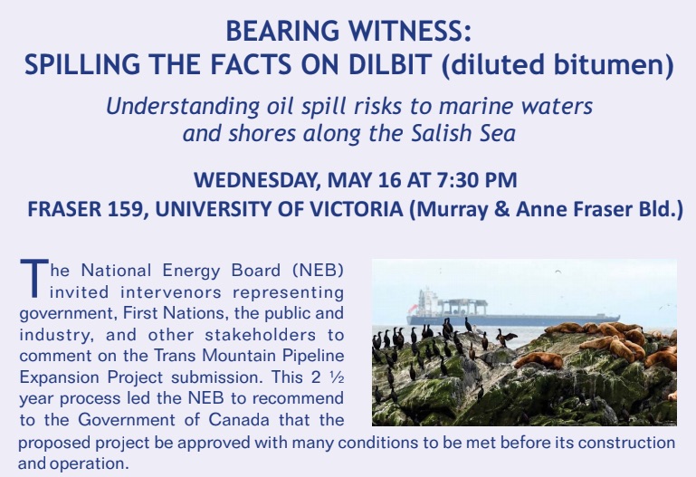
Bearing Witness: Spilling the Facts on Dilbit (diluted bitumen)

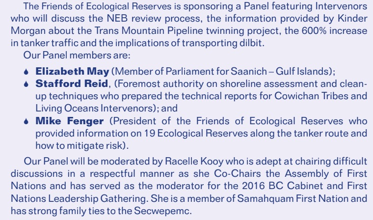
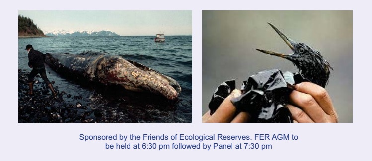
A major concern for those of us who work with Race Rocks is the impending disaster that is likely to happen to the Ecological reserve if the Kinder Morgan Trans Mountain Pipeline is built. The Friends of Ecological Reserves is sponsoring the following panel discussion on threats to our Marine environment which has a good chance of happening if this pipeline gets built and the marine transport necessary for it goes within several kilometers of Race Rocks Ecological Reserve. Also see other posts on the Oil Spill Risk Link.

Under way on Nuclear Power

There was a large roar made by ocean swells breaking and surging on the west and southwest sides of the island, at first light today. Winds abated and light southwest to west winds in the morning turned to light west in the afternoon rising to 15 to 20 knots by evening. The sky cleared by noon and stayed that way until dusk. The barometric pressure continued Monday’s trajectory, rising above 1022 hPa by mid-afternoon and holding there into the evening.. The marine forecast calls for light winds Wednesday and a few days of sunshine.

Four whale watching vessels were observed working in the Protected Area today. All four vessels went around to the outside (south) of South Rock to observe the seals, sea lions and eagles. One sports fisher was observed travelling through the reserve and dip-netting fish near the Rosedale Reef buoy. Forage fish, possibly herring seemed to be boiling up to the surface their drawing numerous eagles, gulls and cormorants.

An Articulated Tug and Barge (ATB), (barge, a loaded oil tanker), was noted outbound, this morning. When we checked for a vessel name on the Automated Information System (AIS), http://www.marinetraffic.com/en/ais/home/centerx:-124/centery:48/zoom:10 it did not show up on the marine traffic system neither did the tug attached to it as a pusher.

A report to the BC Ministry of Environment on the risk of oil spills in BC waters (http://www.env.gov.bc.ca/main/west-coast-spill-response-study/)states that barges are not required to use AIS however their tugs should register. The report goes on to say that a spill from an ATB could exceed 25,000m3 of oil. Fuel barge movement statistics provided by Canadian Coast Guard Marine Communications Traffic Services to the 2013 BC report show over 1000 fuel barges outbound from Victoria, Vancouver, Comox and Prince Rupert and another 514 transiting Victoria alone. Why are they not required to register? There have been several near-miss incidents with these oil carriers; why not use every means possible to maximize safety and reduce risk, such as AIS?

To put things in context, a show of force was led by the USS Shoup heading out to sea, followed an hour later by a very large submarine escorted by a convoy bristling with military might and expense. The usual explosions from Rocky Point put the ar in arsenal.

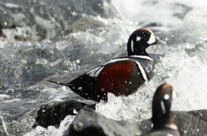
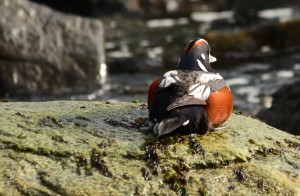
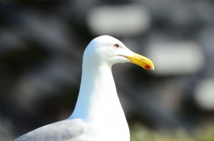
Ecologically, the gulls are becoming more abundant and settled in their nesting spots. Territorial disputes are a daily occurrence now as are the calmer moments of pairs just standing together gazing at and grooming each other. The Harlequin Ducks have been busy with all the whitewater activity and take their rest on the boulder beach just southeast of the main house. Pigeon Guillemots were back for a morning visit to Great Race.

Sea lions and Harbour Seals had really good daytime sleeps today recovering from the storms.

Temporary repairs were completed on damaged roofs, as was clean-up and mopping up from the storm.

Humpback and Orca Sightings from Race Rocks in the Strait of Juan de Fuca

In preparing for the oral presentation that the Friends of Ecological Reserves  will give on January 28 in Burnaby, as an intervenor for the National Energy board Hearings, I have recently updated or graphs on Humpback and Orca sightings by the Ecoguardians at Race Rocks: The posts done by our Ecoguardians tagged for orcas or  humpback whales assisted in this tabulation.

image003 orcadays

Concern for the 19 Marine Ecological Reserves which could be affected by the KM/TMX pipeline.

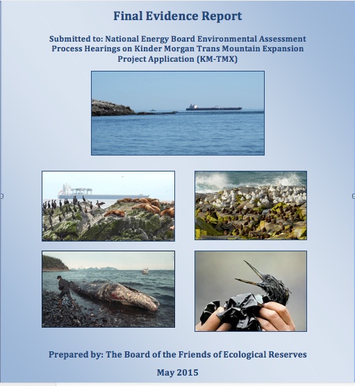
The  Board of Friends of Ecological Reserves,  submitted their final report as Intervenors in the National Energy Board Hearings on the Kinder Morgan Trans Mountain Expansion Project.

The report deals with what they see as a flawed process in the NEB and with the concern  for proper funding from the oil company and ecological monitoring to be provided in Marine Ecological Reserves before any approval of the project can be allowed. It deals with the 19 Ecological Reserves in the Southern part of Vancouver Island, and Juan de Fuca and Georgia Straits. Since Race Rocks Ecological reserve lies within a few kilometres of the proposed tanker route,  it is used extensively for examples in this report. Our thanks to the Race Rocks Ecoguardians of the past few years who have, through their observations and photos provided a valuable resource from which we have drawn data and images.  —Garry Fletcher.

finalreportcover


Misleading information in recent STANTEC report on Whales.

Also see the APRIL 23 post with graphs on Whale Observations from Race Rocks 2009-2014.
I believe that the increasing frequency in recent years in the number of humpback whales observed in the area which will be affected by increased tanker traffic from the Kinder Morgan/ TMX project has not been taken into account In the Consultant’s report issued today
Quantitative Assessment of Increased Potential for Marine Mammal-Vessel Interactions from the Trans Mountain Expansion Project TRANS MOUNTAIN PIPELINE ULC TRANS MOUNTAIN EXPANSION PROJECT -Prepared by: Stantec Consulting Ltd. 500 – 4730 Kingsway Burnaby, BC, V5H 0C6 Ph.: (604) 436-3014, 

Quoted from the report :
“While the BC CSN data includes numerous opportunistic sightings of humpback whales in the study area over the course of the last four decades, the majority of the Marine RSA is generally not recognized as a humpback whale hotspot, although the western extent just overlaps with the eastern-most extent of humpback whale critical habitat –(Fisheries and Oceans Canada 2013a). As such, and since actual humpback whale density values for the Marine RSA (Regional Study Area) do not exist, this species was assigned a density according to the lowest density observed for humpback whales during the surveys reported on in Best and Halpin (2011) elsewhere in BC ((Williams and Thomas 2007) did not observe any humpback whales during their summer 2004 survey in this area) This value corresponds to roughly 10 whales distributed across the majority of the Marine RSA

——As a result, humpback whales were assigned a proportion of time in the study area of 0.17 (i.e., two months of the year) based on the largest concentration of sightings from the BC CSN data (British Columbia Cetacean Sightings Network 2013)”

Here is a good example, in my opinion,  of how a decision having long term implications regarding the welfare of a species recovering from near extinction may be completely misdirected if based only on a consultants interpretation of officially published scientific resources which can quickly become dated.

G.Fletcher