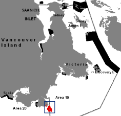
 General map of the Southern end of Vancouver Island. Race Rocks and Bentinck Island are in Area 19.
The DFO original of these maps and charts is here: http://www.pac.dfo-mpo.gc.ca/fm-gp/maps-cartes/rca-acs/rca-acs/south-sud/BentinckRaceRocksChart3461-eng.html
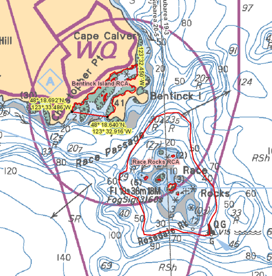
Bentinck Island – Chart 3461
Those waters of Eemdyk Passage in Subarea 20-5 that lie westerly of the meridian passing through 123°32.450’ west longitude and northerly of a line:
| from | 48°18.692’N | 123°33.486’W |
|---|---|---|
| to | 48°18.640’N | 123°32.916’W |
Race Rocks – Chart 3461
Those waters of Subareas 19-3 and 20-5 that lie inside the 40 metre contour line surrounding Great Race Rock and Rosedale Rock as shown on Chart No. 3461, published by the Canadian Hydrographic Service of the Department.
- Date modified by DFO:
- Return to the Regulations for Race Rocks file https://www.racerocks.ca/?p=8909